TAMPA, Fla. (WFLA) — Saturday starts off mild and cloudy in Tampa Bay, but we expect widespread showers and thunderstorms to move through our area.
What to expect:
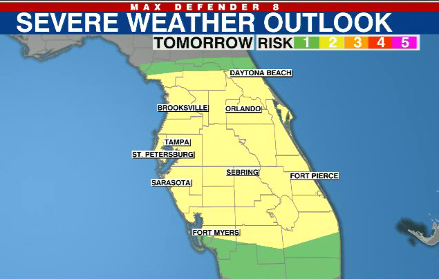
We have a low risk (Level 2 out of 5) for a severe storm. We are most worried about damaging gusty winds, temporary flooding and an isolated tornado.
Saturday morning will be mostly cloudy and mild, with temperatures in the upper 60s and low 70s.
We will make it through Saturday morning without widespread chances for showers. We may see an isolated southern shower but most of us will be dry through the lunch hour.
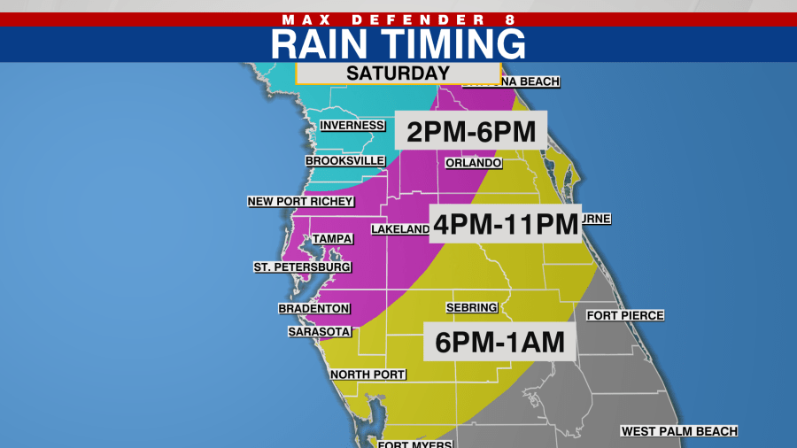
When will storms move in?
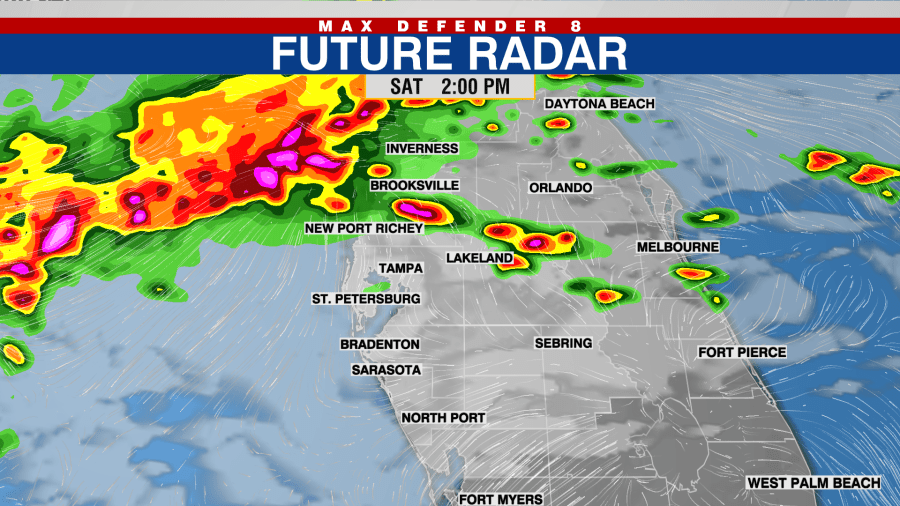
Beginning around 2 p.m., we will see a line of storms moving into Citrus and Hernando counties, as well as northern and western Pasco, from the Gulf.
The rain is expected to be prevalent along the Nature Coast through around 6 p.m.
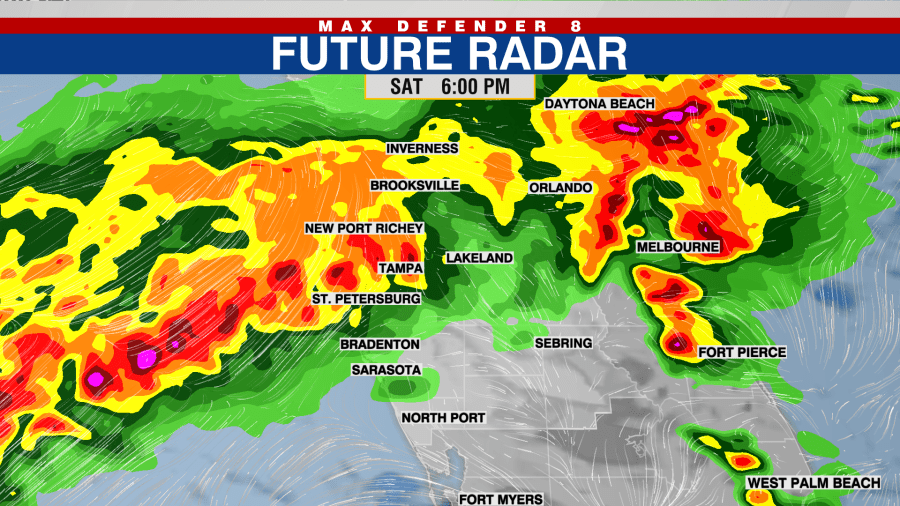
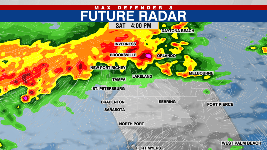
By 4 p.m., the storms will push into southeastern Pasco, Pinellas, Hillsborough, northwestern Polk and northern Manatee counties. The heaviest of the rain will be in those areas through 11 p.m. Saturday.
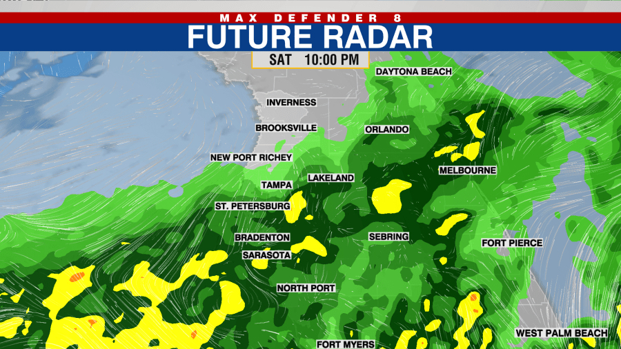
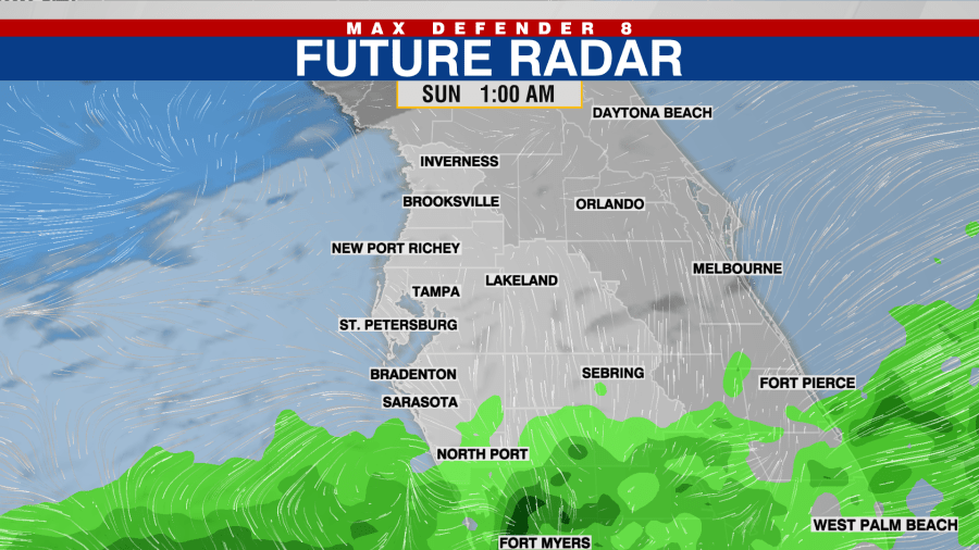
Manatee, Sarasota, Hardee, DeSoto, southeastern Polk and Highland counties have the driest day on Saturday. The rain doesn’t begin to move into these areas until 6 p.m. but it will rain into the early morning hours on Sunday across the southernmost parts of these counties.

The highest threat for severe storms will be along the leading edge of the storms pushing onshore from the Gulf of Mexico.
The intensity of the storms fades during the latter part of the evening. Our southernmost counties will most likely just see rain, with the lowest chance for severe storms.
Looking ahead, we will wake up to some showers on Sunday morning, but we will dry out during the afternoon hours.


