TAMPA, Fla. (WFLA) — The coldest air since last February is hours away from reaching the Tampa Bay area and it has traveled very far to reach it’s destination – all the way from Siberia.
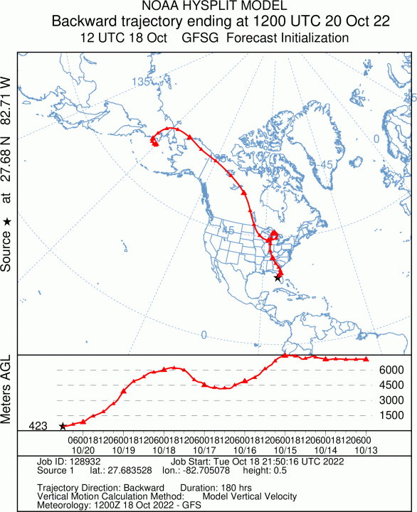
Now that may seem like an exaggeration. But meteorologists have a tool to track the origination of airmass. It’s called the NOAA HYSPLIT model and when you run it backward, you discover where an airmass came from.
In this case, the air started a week ago across Siberia, headed down through Alaska, then Canada. Now, with the help of a strong cold front, it’s moving into Florida. So it’s not an exaggeration to say the air you are inhaling this week comes from the Arctic!
This HYSPLIT image shows the trajectory. Of course the air moderates the further south it moves.

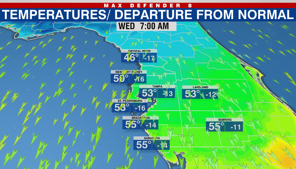
It is not uncommon in winter for airmasses to originate in the Arctic. Although it is certainly early for this type of cold, with temperatures in the Bay area forecast to run 15 to 20 degrees below normal through Thursday morning – readings more typical in January.
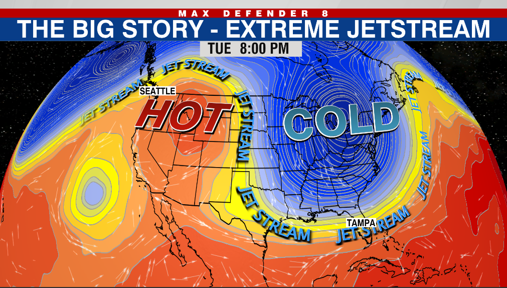
With the pattern so upside down across the U.S., Tampa will find itself in rare territory Wednesday with a high temperature several degrees above that of Calgary, Canada!

An early season pattern, not unlike a Polar Vortex, has developed across the Great Lakes. It is associated with a very extreme jet stream pattern, pumping warm air northward along the West Coast and plunging cold air southward in the east.

Over a foot of snow has fallen across the Upper Peninsula of Michigan and dozens of record lows have fallen. Freeze warnings cover a huge chunk of real estate tonight across the Southeast U.S., with another 50 record lows possible.
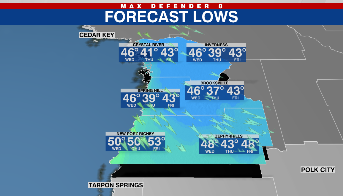
The Bay area will wake up to lows of 45 to 50 on the Nature Coast and in the 50s from Tampa Bay South.

On Wednesday, despite good sunshine, temperatures will struggle to climb out of the 60s. Most of the day will be no higher than the mid-60s.
The coldest morning will be Thursday morning, with low temperatures forecast to to flirt with 40 in the northern Nature Coast. Some isolated locations, away from the Gulf, may briefly dip into the upper 30s.

Temperatures will begin to rebound Friday afternoon and by Sunday, mid-80s will return for highs, which is normal for this time of year. But humidity will still be low.


