TAMPA (WFLA) — Over the past few weeks, La Niña has grown stronger. This is due to a surge in easternly Trade Winds that blow cool water from the Eastern Pacific to the Western Pacific along the Equator. This reinvigorates the already present La Niña.
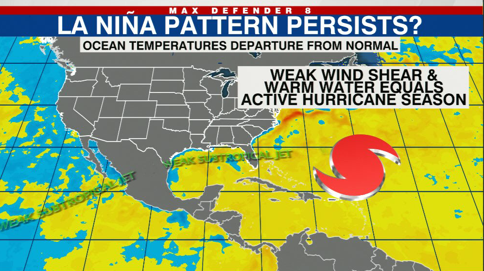
This is concerning because La Niña’s typically correspond with active hurricane seasons in the Atlantic Ocean. The last two hurricane seasons have featured La Niña and both have been very active in the Atlantic Basin.
The hope and expectation were that La Niña would fade before summer, maybe even reversing to El Niño. But that no longer seems probable.
La Niña is a cooling of the surface waters in the Equatorial Pacific Ocean. This tends to weaken the subtropical Jetstream, making it dry in winter in the Southeast, including the Tampa Bay Area. That has been true this winter.
But when La Niña extends into the summer, it can mean more active hurricane seasons. The same effect is in play in which weak upper-level winds extending from the Pacific into the Atlantic allow hurricanes to fester over the Atlantic.
The opposite is true of El Niño. Warm waters in the Tropical Pacific fuel a stronger subtropical jet stream during winter, wetter conditions in Florida and if it persists through hurricane season, the stronger upper-level winds can tear hurricanes apart over the Atlantic.
The recent increase in easterly trade winds has indeed intensified the ongoing La Niña. The reason for this can be explained by the physical dynamics that control it.
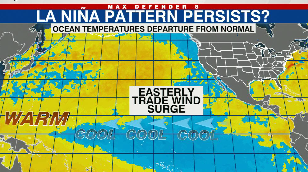
When winds blow east to west across the Equatorial Pacific, cool water is forced west across the basin. That pushes warm water further west towards Asia. Replacing that cool water in the Eastern Pacific is more cool water from down below. This is called upwelling.
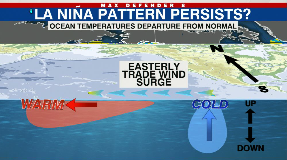
The eastern wind burst which has taken place in recent weeks has invigorated what looked to be a weakening La Niña. It is not weakening anymore.
While there is still some chance it will weaken by summer, transitioning to a neutral event, it is now much less likely to become an El Niño. That will likely mean we will not have El Niño’s helping hand to guide us through hurricane season.
That’s too bad because summers with El Niño tend to produce fewer hurricanes. In the image below, since 1995, El Niño years have featured an average of between four and five hurricanes. Whereas summers that have La Niña, or a neutral event, tend to be much more active with an average of eight hurricanes.

The La Niña effect of weaker upper-level wind shear and more Atlantic activity can be intensified by warmer Atlantic Ocean waters. That is present right now and it will likely continue into summer.
Hurricane season is still more than two months away and a lot can change between now and then, but if past seasons are any indication, we should be prepared for an active summer ahead in the Atlantic Basin.


