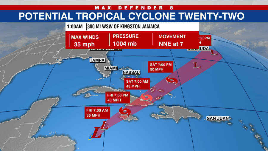
TAMPA, Fla. (WFLA) — The National Hurricane Center issued Tropical Storm Watches ahead of Potential Tropical Cyclone 22, which was initially predicted to become a tropical storm on Friday.
As of this report, the system is located about 50 miles southwest of Montego, Jamaica, according to the NHC. Its maximum sustained winds are 35 mph, with higher gusts.
However, even though the system is expected to gradually strengthen, the chances of it becoming a tropical cyclone are decreasing, forecasters said.
A Tropical Storm Watch is in effect for the following areas:
- Jamaica
- Haiti
- Cuban provinces of Guantanamo, Santiago de Cuba, Holguin, Granma and Las Tunas
- Southeastern Bahamas and Turks and Caicos Islands
On Friday morning, the system was attempting to become better organized.

NHC gave the system a 40% chance of formation over the next 48 hours. Regardless of development, the storm is expected to dump several inches of rain in Central America and the Caribbean.
According to the NHC, 4 to 8 inches of rain (up to 16 inches in some areas), is expected for portions of Jamaica, southeast Cuba, and Hispaniola. Forecasters warned of the potential for flash flooding, along with mudslides in areas of higher terrain.
Two to 4 inches of rainfall are expected across the southeastern Bahamas and Turks and Caicos Islands through Sunday morning.
If this system becomes a tropical storm, it will be named Vince.


