This story is no longer being updated as of Oct. 5. Click here for updates.
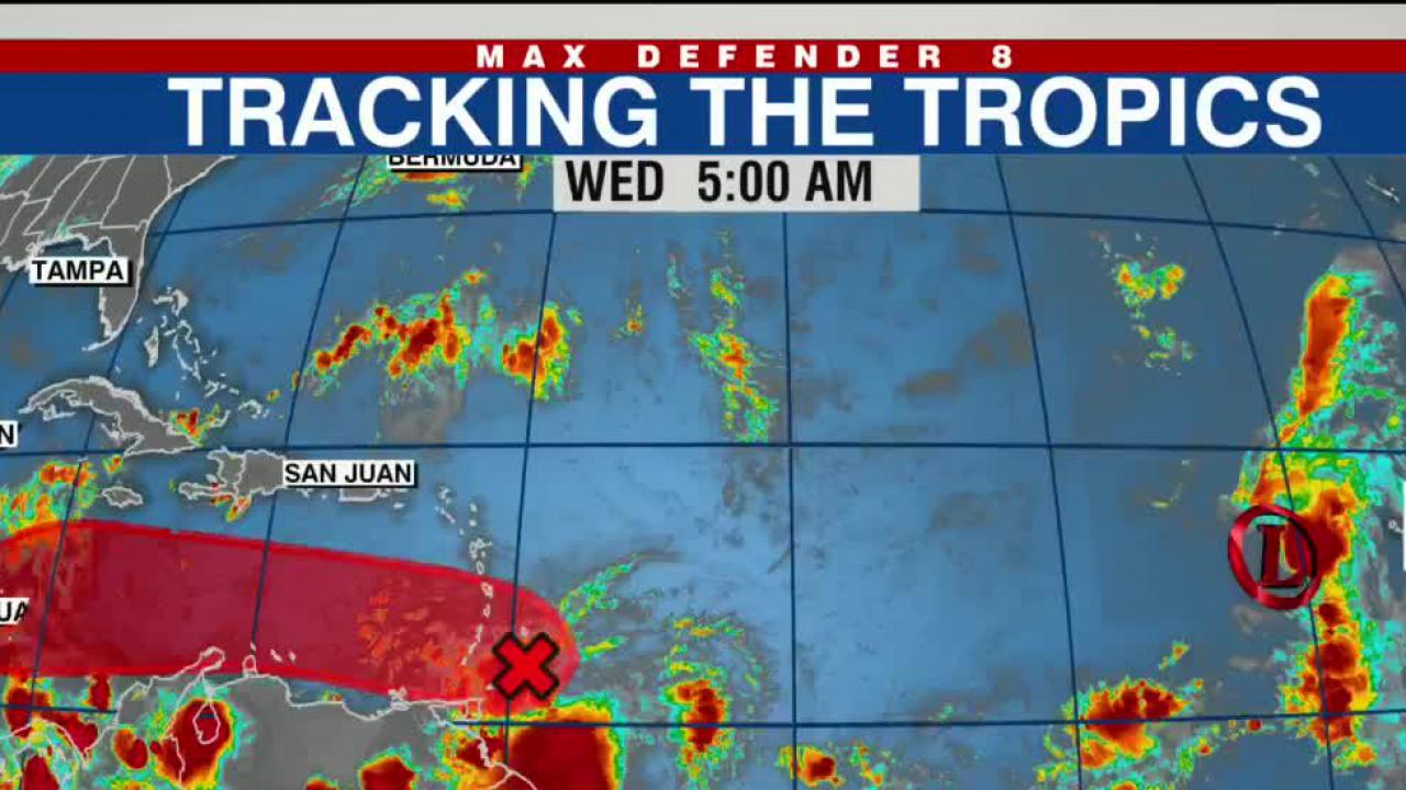
TAMPA, Fla. (WFLA) — The tropical depression that formed over the Atlantic on Tuesday is forecast to weaken in the coming days and fizzle out, according to the National Hurricane Center.
At 11 a.m. Wednesday, Tropical Depression 12 was about 530 miles west of the Cabo Verde Islands with maximum sustained winds near 35 mph, the NHC said in its advisory.
The depression, which formed Tuesday afternoon, was moving west-northwest, and will likely continue that northwestward trek through Thursday, the center added.
“Slow weakening is forecast, and the depression is expected to become a remnant low by Thursday,” the advisory said.

Forecasters are also watching a broad area of low pressure with showers and thunderstorms just east of the Windward Islands.
That system has a high chance of developing into a tropical depression as it moves westward over open waters through those islands and into the Caribbean Sea, and enters conditions favorable for development, the center said.
It has a medium 60% chance of becoming a tropical depression in the next two days, and a high 80% chance of becoming one in the next five, according to the NHC.
Regardless of development, it is expected to produce bouts of heavy rain with localized flooding over portions of the Windward Islands, northern portions of South America, and the ABC Islands over the next couple of days.
The next named storm of the 2022 Atlantic hurricane season is Julia.


