This story is no longer being updated. Get the latest forecast track here.
TAMPA, Fla. (WFLA) – Neighborhoods were flooded Wednesday night and early Thursday morning as Tropical Storm Eta made its way past Tampa Bay.
The storm slowly worked its way up the Gulf of Mexico on Wednesday, battering Florida’s west coast with tropical-force-winds and heavy rain. Those impacts tore off roofs, flooded streets and knocked out power to nearly 50,000 homes.
Eta finally made landfall in Cedar Key, Florida around 4 a.m. ET Thursday, according to the National Hurricane Center.
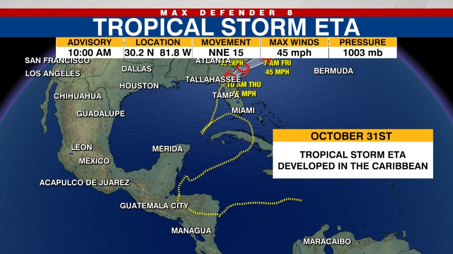
By 1 p.m. Thursday, Eta had already moved over the Florida peninsula and was starting to emerge back over the Atlantic near the border of Florida and Georgia. The tropical storm weakened slightly with maximum sustained wind speeds of 40 mph as it moved north-northeast at 15 mph.

Little change in strength is expected for Eta through Friday, the NHC says. The system is forecast to emerge into the western Atlantic by early Thursday afternoon and then move parallel to – but offshore of – the Carolinas before moving well east of the Atlantic coast.
The NHC says Eta could re-intensify as a non-tropical cyclone on Friday but is expected to become absorbed by a larger non-tropical cyclone on Saturday.
Eta could still dump another 1 to 3 inches of rain on Florida Thursday, with South Florida seeing isolated amounts of 20 to 25 inches. A storm surge of 1 to 3 feet is possible along much of Florida’s west coast.
The storm surge and tropical storm warnings that were in place for parts of Tampa Bay have been discontinued.
Eta, the 28th named storm of a very active hurricane season, first made landfall over Central America as a Category 4 hurricane before slamming Cuba and the upper Florida Keys.
The Atlantic hurricane season has seen 29 storms, breaking the 2005 record of 28 named storms.
Theta, the 29th storm, formed in the northeast Atlantic Monday night. The NHC says Theta, now a tropical storm, was about 470 miles south-southwest of Azores, moving northeast with little change in strength.
The NHC is also monitoring a tropical wave that’s producing a large area of showers and thunderstorms over the central Caribbean Sea. The most recent tropical weather outlook from the NHC says the disturbance is gradually become better organized. A tropical depression is expected to form in the coming days as the disturbance moves west over the Caribbean.
TRACKING THE TROPICS:
- Hurricane Idalia claimed 12 lives, caused $3.6B in damage, NHC report finds
- Tracking the Tropics ends for the season
- Tracking the Tropics team takes a look back at the 2023 hurricane season
- What does the El Niño weather pattern mean for winter?
- Late-season system in Atlantic has 60% chance of development, NHC says


