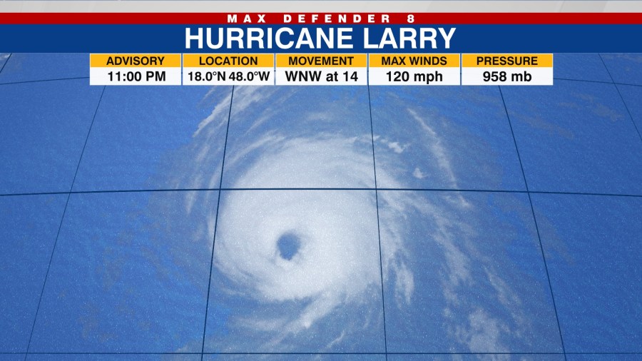
TAMPA, Fla. (WFLA) – The National Hurricane Center is still monitoring Hurricane Larry, which has become a major hurricane.
The latest model tracks show no apparent threat to the Sunshine State as the tropical system squeezes between a high-pressure system and front coming off the US coast and the mid-Atlantic high-pressure further west. This keeps Larry tracking much more north rather than up against the U.S coast.

The Max Defender 8 Weather Team is also tracking a short wave through Central America near the Yucatan Peninsula. They expect this system to lift northeast into the Gulf through the next five days, which may lead to more organization and potentially a tropical system. This particular wave will have our attention as we move forward into our short business week ahead.
Below are the latest details on Hurricane Larry from the NHC (Sept. 4 — 11 p.m.):
- About 910 miles east of the Leeward Islands
- 120 mph maximum sustained winds
- Presently moving west-northwest at 14 mph
- There are no coastal watches or warnings in effect
- Larry is a category 3 hurricane on the Saffir-Simpson Hurricane Wind Scale and additional strengthening is forecast over the next day or two. Little change in strength is forecast during the next few days, although fluctuations in intensity will be possible. It is expected to remain a major hurricane through the middle of next week.


