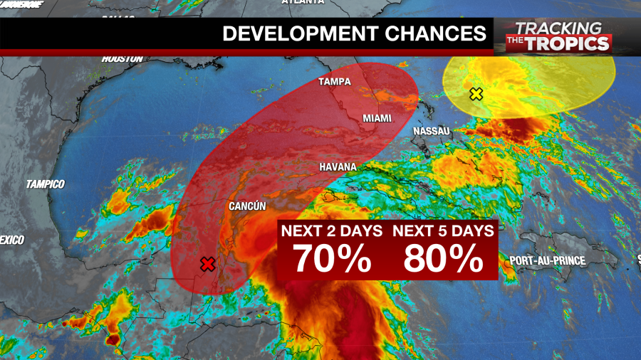
TAMPA, Fla. (WFLA) — The 2022 Atlantic hurricane season is now officially underway, and there’s already an area of potential development to keep an eye on in the Gulf of Mexico.
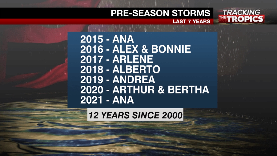
The Atlantic hurricane season begins every year on June 1. This year marked the first time in seven years that tropical development did not occur in the Atlantic before June 1.
However, the National Hurricane Center is tracking possible development in the southern Gulf of Mexico and says a tropical depression or storm is likely to form by the end of the week.
What we’re tracking
The area of possible development being monitored is leftover shower and thunderstorm activity from Hurricane Agatha, a storm in the Pacific. The system developed in the Pacific and moved onshore in Mexico as a Category 2 hurricane on Tuesday.
The mountainous terrain of Mexico shredded Hurricane Agatha apart but the tropical moisture has moved into the Bay of Campeche, the Caribbean Sea and over the Yucatan Peninsula, and is expected to re-strengthen.
Forecast models show a good chance that the showers and storms re-organize into a new tropical system by the end of the week as the moisture continues to move northeast toward Florida and Cuba. While it is not forecast to be a well-organized system with strong winds, it could bring heavy rainfall to parts of the state Friday into Saturday.
Confidence in the forecast will increase Thursday after the disturbance organizes a little more. Currently, the forecast models are having a tough time predicting where the center of the disturbance will organize.
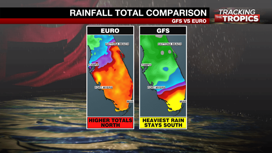
The farther north it develops, the farther north the rain will spread. The European model suggests the rain will be heaviest along and south of I-4. The American model (GFS) suggests the heaviest rain will stay in south Florida, over the Everglades and Miami.
If the remnants redevelop and wind speeds reach at least 39 mph, it would be the first named storm of the Atlantic hurricane season and would be given the name Alex. For now, the NHC is calling the area Invest 91L. Forecasters give it a 70% chance of developing in the next two days and an 80% chance of developing in the next five days.
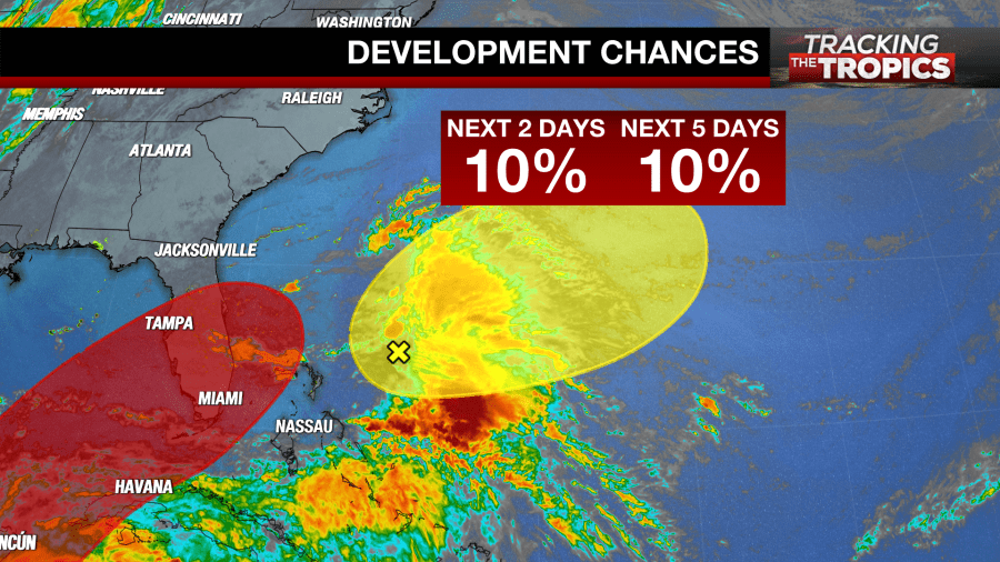
The NHC is also monitoring a weak disturbance near the Bahamas but says further development of this area is unlikely. They give it just a 10% chance of developing within the next two and five days.
Start of hurricane season
It is not uncommon to track a weak disturbance or two this early in the season. The Gulf of Mexico, western Caribbean and western Atlantic are hot spots for development in June.

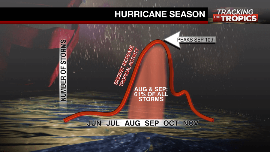
On average, however, 61% of all named storms develop in August and September, with the peak of the season on Sept. 10. October sees a fair share of storms as well with activity winding down in November.
The strongest storms are typically in the middle of hurricane season as well, with water temperatures being at their warmest.
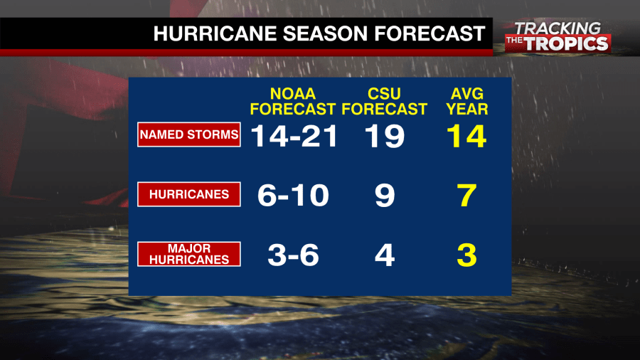
This year, both NOAA and Colorado State University are forecasting an above-average hurricane season. This would mark the seventh consecutive above-average hurricane season in the Atlantic, according to NOAA.
One of the reasons another above-average year is expected is the continuation of La Niña. La Niña leads to favorable conditions for tropical development in the Atlantic ocean with weaker upper-level winds. This allows tropical systems to organize.
2022 hurricane season names
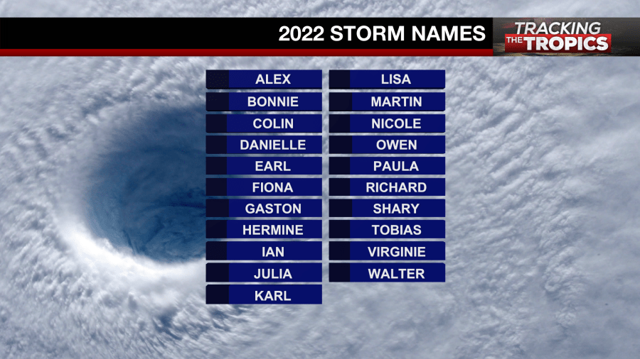
Any tropical disturbance that organizes with maximum sustained winds of at least 39 mph will get a name. The first name on the 2022 Atlantic hurricane name list is Alex. Alex is followed by Bonnie, then Colin and Danielle.
Tracking the Tropics
Tracking the Tropics streams every Wednesday at 2 p.m. ET throughout hurricane season, or whenever there’s an active system to track. Meteorologists and weather experts from across the country will join each week to answer viewer questions live.
