TAMPA, Fla. (WFLA) — The National Hurricane Center is tracking a disturbance in the Atlantic that is likely to develop over the next week.
On Monday, meteorologists were monitoring the southwestern Caribbean, where an area of low pressure is likely to form off the coast of Central America.
A tropical depression is could form late this week while the system drifts northeastward across the western and central portions of the Caribbean Sea, the NHC said. Forecasters said those in Jamaica, Haiti and the Dominican Republic should keep an eye on the system.
“This system will gradually head northeast, but should stay south of Florida,” WFLA meteorologist Leigh Spann said.
The system has a 70% chance of development over the next seven days.
“Regardless of development, this system has the potential to produce heavy rains over portions of the Caribbean coast of Central America and the Greater Antilles towards to latter portions of this week,” NHC forecasters wrote.
Rain on the way: Here’s when we can expect showers in Tampa Bay

Forecasters are also tracking an area of low pressure that will move east along the Gulf coast this week.
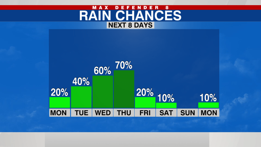
The system is expected to bring some much-needed rain to the Tampa Bay area, but it is not expected to produce severe storms.
“This is basically a cloud, rain event that could bring us well-needed rain, up to a couple of inches, mainly late in the day Wednesday through Thursday,” WFLA meteorologist Eric Stone said.
Watch Tracking the Tropics Wednesdays at 12:30 p.m. ET/11:30 a.m. CT.
Be prepared with the WFLA Hurricane-Ready Guide 2023 and stay ahead of tropical development with the Tracking the Tropics newsletter.


