TAMPA, Fla. (WFLA) — Tropical Depression Nine formed over the Caribbean Sea on Friday and soon became Tropical Storm Ian. Now, it’s expected to strengthen into the next hurricane as it take aims at the Gulf coast.
The latest forecast track for the system shows it reach major Category 3 hurricane strength in the Gulf of Mexico as it approaches Florida next week. Some shifts in the track are expected in the coming days as better data comes in and as meteorologists see how the system is potentially impacted by any land interaction.
Some models show the system staying in the Gulf of Mexico longer while others show it headed further south in Florida. Regardless, the system is expected to impact the forecast in Tampa Bay.
Here are some of the different scenarios that are possible:
If it goes further south
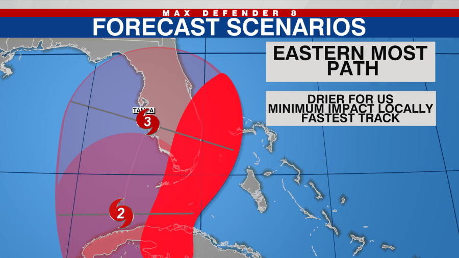
If the system takes a more southerly track – the eastern most end of the forecast cone – the Tampa Bay weather will stay much drier.
The system would be weaker due to more land interaction with mountainous Cuba. This would also be a faster solution moving toward south Florida and push the storm out quickly.

Overall, a southerly track could lead to fewer impacts here in the Tampa Bay area. A storm moving through the Keys and toward Miami would have minimal impacts overall locally, but a storm moving through Ft. Myers could still have wind and rain impacts for our southern counties.
If it heads north
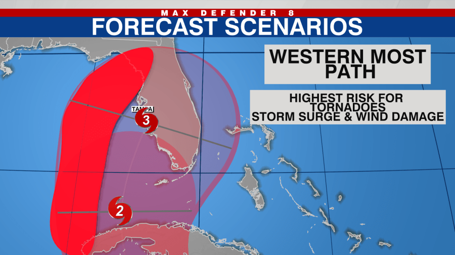
A storm taking a westerly track, toward the Nature Coast, would mean far more impacts to the Tampa Bay area.
The storm would have a longer period of time over water and less interaction with Cuba, meaning a stronger storm is possible. The caveat to the that is that the longer the storm sits over water, the more wind shear it will have to battle which could keep it a little weaker.

Either way, being on the eastern side will lead to stronger winds along the coastline and inland.
It would lead to a risk for storm surge, depending on tides and how close or far away the center of the storm was. This path would also increase the risk for tornadoes in rain bands.
A ‘middle of the road’ path
This would bring the strongest winds to the central Tampa Bay area. Storm surge, flooding from heavy rains, wind damage and isolated tornadoes would all be possible.
It is possible for a middle of the road path but it is too soon to tell where exactly the center of the storm will be Tuesday and Wednesday this far out.

“While it is looking more and more likely impacts will be felt somewhere in Florida from this storm, it is too soon to talk about specific impacts for any area right now,” Meteorologist Amanda Holly said. “It is best for everyone living in Florida to double check your hurricane kit this weekend and check back in a couple times a day for updates and changes.”


