TAMPA, Fla. (WFLA) — The mountainous islands of Hispaniola took a toll on the structure of Fred Wednesday. It struggled to reorganize Thursday and continues to look ragged on satellite Friday morning. The low level center of circulation is hard to make out on satellite and the showers and thunderstorms are displaced far to the south of Cuba.
With the lack of organization, there are still question marks with exactly how much Fred will strengthen. The official forecast is still for it to slowly regain tropical storm strength over the next 24 hours.
Near-term, the low level center is forecast to parallel the northern Cuba coastline.
Eventually, Fred will take a turn to the north and as always, the timing of the turn will be key and make all the difference in any effects Tampa Bay may feel from Fred.
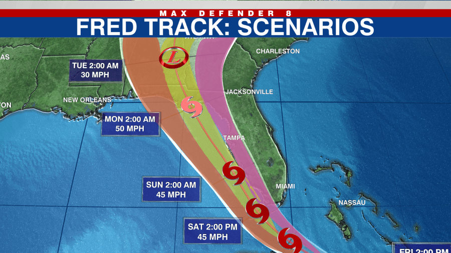
As of Friday morning, three scenarios remain possible with the current National Hurricane Center cone of uncertainty forecast.
- An easterly path taking the center of Fred over land.
- A path that keeps the center just offshore of the Florida’s west coast, in the Gulf of Mexico
- A westerly path farther offshore and away from land bringing it toward the western Florida panhandle.
Keep in mind when looking at the cone, the center of Fred will be somewhere within the bubble during the time frame impacts will be felt outside.
Scenario 1
The first scenario, a path on the eastern side of the cone of uncertainty, would mean a much weaker Fred. The center of Fred would move over land up Florida’s west coast.
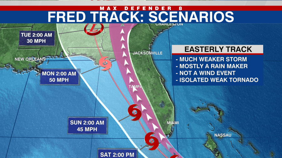
With a lack of a warm water source, Fred would gradually just get weaker. Rain would still be likely, especially for Florida’s east coast and winds would be breezy. There would be a low-end tornado threat on the eastern side of the center. This would be a very small impact on Tampa Bay, with the exception of elevated rain chances on Sunday.
Scenario 2
The second, still most likely scenario, as of Thursday, would be a path that takes the center of Fred just offshore of the Tampa coastline. The National Hurricane Center continues to lean toward this solution.
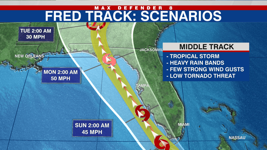
Since the center of Fred would still be over warm waters, it would likely be a mid-grade tropical storm as it passed by. Tampa would expect passing gusty, tropical rain bands to start early Sunday morning. There would be a low tornado threat within the rain bands.
The main hazard to look out for with this path would be localized flooding. It could occur in some spots that are already saturated, especially alone the coast, from heavy thunderstorms this week. Localized rainfall totals could be up to six inches.
Scenario 3
A track in the western section of the cone would most likely result in a stronger Fred, possibly a strong tropical storm with plenty of warm water to fuel strengthening and very little land interaction over the weekend. However. wind shear would keep it a weaker storm overall.
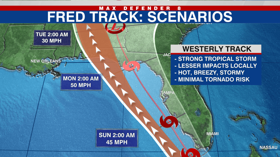
The strongest winds would be offshore in this case with Tampa Bay seeing a hot and gusty day. Showers and storms would still pass through and may be enhance so flooding could still be an issue. The tornado threat would be low in any rain bands that did make it onshore.
All three scenarios are possible and the timing of the turn north will be key in determining which path Fred will eventually take. This also results in the intensity forecast being uncertain because it could be stronger or weaker if it goes west or east.


