TAMPA, Fla. (WFLA) — Potential Tropical Cyclone One is passing just to the south of the Tampa Bay area this morning. Heavy rain and breezy winds have been impacting south Florida since yesterday. The tropical system remains asymmetric and disorganized and will not organize any further today. It could still become a tropical storm, but not until after it passes Florida.
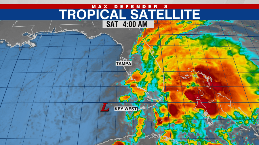
All of the rain associated with the tropical disturbance is on the eastern side, meaning as it passes the state today, rain chances will actually come down as the tropical moisture moves into the Atlantic.
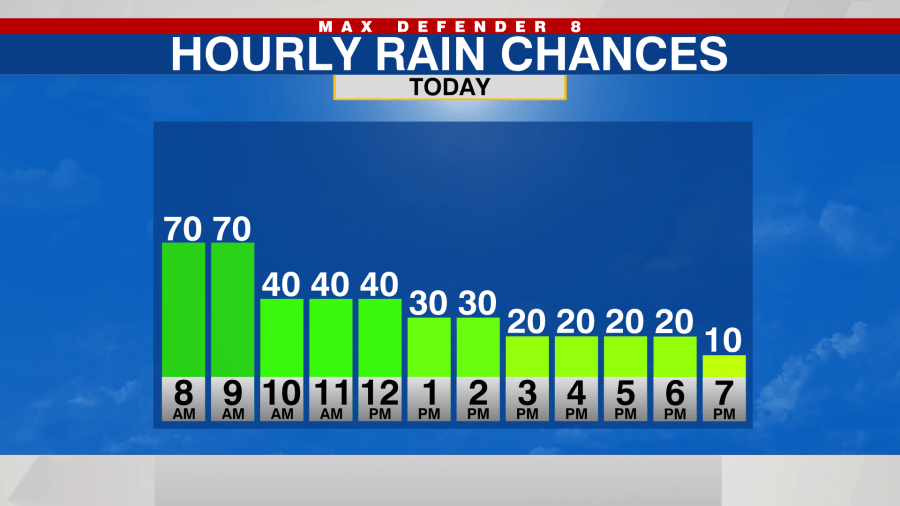
Winds will still be breezy at best, northeast 15-25 mph at times. Skies will be partly cloudy and a few quick passing showers will be possible but overall the coverage of rain will be significantly lower after the lunch hour today.
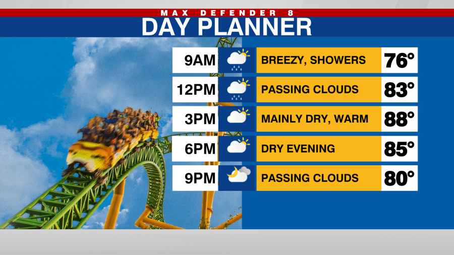
Although conditions will be improving today, dangerous rip currents will be possible through Sunday. Seas will be quite rough today and begin to calm down tonight.
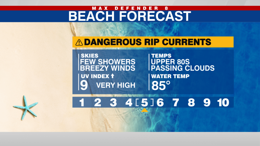
Temperatures will warm into the upper 80s this afternoon. It will be dry tonight with lows in the mid-70s.
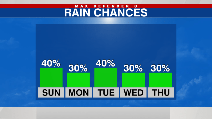
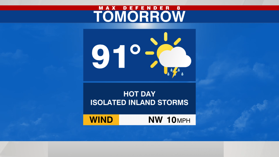
Sunday will start out dry and mild. A few clouds will develop in the afternoon and rain chances will increase to a 30% for a few inland afternoon/evening storms.
A typical summertime pattern will continue next week with mild mornings and warm afternoons. Showers and storms will develop each day.