TAMPA, Fla. (WFLA) — Two tropical depressions could form in the Atlantic in the coming days, according to the National Hurricane Center.
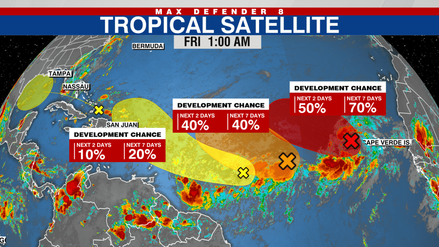
On Friday, the NHC said it is tracking four areas of interest, with two in the east and central Atlantic showing signs of possibly forming into tropical depressions.
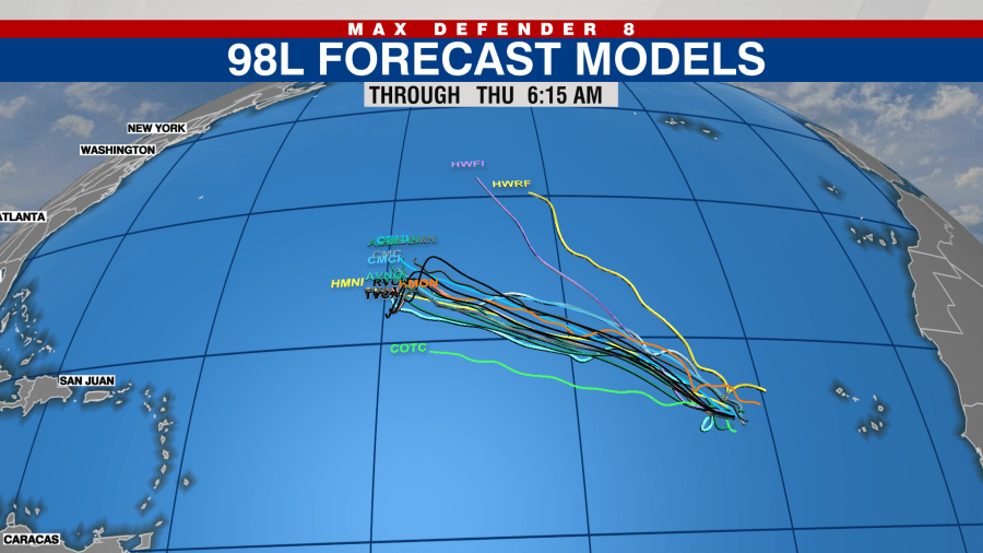
“The tropical waves in the eastern Atlantic Ocean have a better chance to develop into a tropical depression or storm in the next few days,” Max Defender 8 meteorologist Leigh Spann said. “Model data suggests that these will curve north and stay open water.”
According to the latest forecast, the stronger of these two areas, Invest 98L, is in the eastern tropical Atlantic about a few hundred miles west of the Cabo Verde Islands.

This area is forecast to form into a tropical depression over the weekend as it moves west at around 10 mph. As of this report, the system has a 60% chance of development over the next two days and a 70% chance over the next week.
The other system, Invest 99L, is halfway between the Cabo Verde Islands and the Lesser Antilles in the Caribbean. It has “marginally conducive” conditions to develop, but it could still form into a tropical depression in the next few days, according to the NHC.
This system has a 40% percent chance of formation over the next seven days.
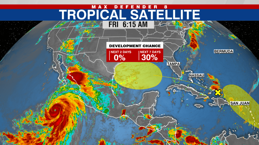
Two other areas are also being tracked in the western Gulf of Mexico and the Lesser Antilles, but they have low development chances.
“The tropical Atlantic Ocean is becoming more active,” Spann said. “A tropical wave in the Bahamas should pass over Florida this weekend. Once it arrives in the central Gulf, it has a small window to organize before arriving on the western Gulf Coast.”
If any of the areas strengthen to tropical storm strength, the next one would be called Emily.


