TAMPA, Fla. (WFLA) — A progressive, or active, pattern is setting up over the southeast for the next week or so. This means that every two or three days a new storm system will pass through bringing showers, storms and even strong storms, depending on the system.
As each system gets closer, be sure to check in for the chance of severe weather. After each front that passes, temperatures will drop slightly.
Below is a timeline of the three systems we’re tracking over the next week and approximately when they will move through the Tampa Bay area.
Front #1 – Wednesday Night
The first cold front will bring a few showers, beginning after 4 p.m. Wednesday. Showers will be possible Wednesday night through Thursday morning, before sunrise. This front is not expected to bring a lot of rainfall and accumulations will vary between just a trace to an inch in places.

It will be dry after Thursday morning through early Saturday morning.
While temperatures will stay milder overnight with the clouds and rain, the cooler air moves back in Thursday afternoon. Friday and Saturday will be milder, ahead of the next front.
Front #2 – Saturday
A stronger cold front will bring another, heavier, round of rain Saturday morning. There could be a few stronger storms embedded within a line of showers and storms with this front as it passes.

This rain will clear out briefly Saturday afternoon before showers, nothing severe, return Sunday.
The cooler air will return Saturday night and Sunday will be cool with highs in the 60s.
Front #3 – Monday/Tuesday
A few showers, maybe a thunderstorm, will be possible Monday afternoon as a warm front lifts north through Florida. The cold front will follow, with showers and thunderstorms Tuesday.
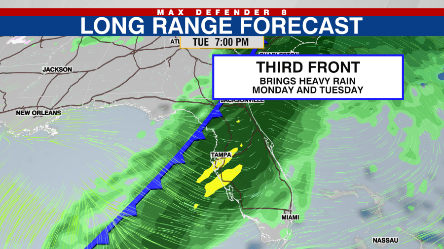
Cold air will move back in Tuesday night with below average temperatures expected again by Wednesday.
Longer Range Forecast
The active pattern with fronts every two to four days looks to continue through the second weekend of the year.


