TAMPA, Fla. (WFLA) – Today was windy & warm- we topped out in the upper 80s with southerly winds around 20 mph. This evening will be warm and breezy, with temperatures slowly sinking out of the 80s and remaining in the mild 70s overnight. Winds will be out of the south between 10-15 mph overnight with a few clouds building.
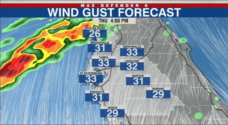
Thursday starts off mild and breezy, in the low 70s. The winds build again during the day- they will be sustained around 20 mph with gusts around 30 mph by the afternoon hours. The winds peak in the afternoon before a line of storms begins to move onshore ahead of a front.
The storms will push onshore in the Nature Coast between 5-7 p.m. The rain moves into Pinellas, Hillsborough, and Polk counties between 7-9 p.m. The storms weaken considerably by the time they make it into our southern counties of Sarasota, Manatee, Hardee, DeSoto, and Highlands after 9pm.
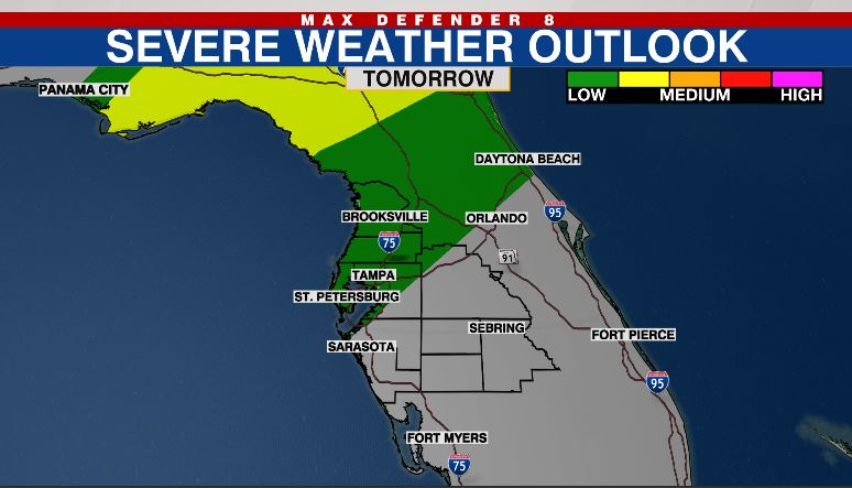
The front may produce a severe weather outbreak across the northern Gulf Coast, but the threat for severe weather is much less by the time it reaches central Florida.
The main threat for any severe storms will be damaging wind gusts when the line of rain first arrives late Thursday.
The front stalls across our area, so rain will redevelop across our area Friday morning, but pushes into our southern counties by the mid day, and mostly out of our are by Friday afternoon. Temperatures will be warm, in the low to mid 80s Friday afternoon.
Saturday looks like it will be the wettest day of the weekend, rain redevelops across our area and we could see significant periods of time where we will see rain. Chances for rain linger overnight Saturday.
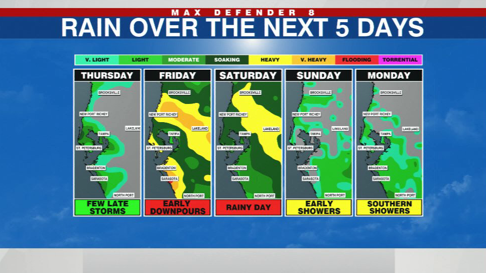
Sunday starts off damp, but is expected to dry out during the day. We can’t rule out a spotty Southern shower Monday, but the day will be mostly dry.
Warm temperatures are back next week, but we will see rain chances again by the latter half of the work week.