TAMPA, Fla. (WFLA) – Today was warm – we hit 82 degrees, just shy of our high temperature record for today, which was 83. We were dry and humid, with a warm southerly breeze.
Tonight is lovely, with temperatures slowly cooling down through the 70s under partly cloudy skies. It could be breezy at times, especially along the coast. We may see some coastal fog between midnight and 4 a.m. Then we have a chance for inland fog between 4 – 7 a.m. Any fog should clear quickly as temperatures start to warm and our winds begin to pick up.
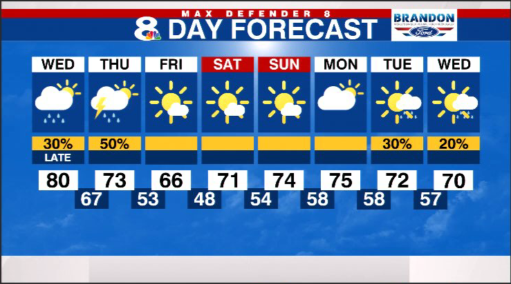
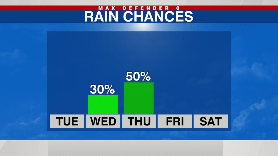
Wednesday will be a bit more cloudy, but still warm, topping out in the low 80s. It will be breezy, with 10-15 mph winds and gusts closer to 20 mph.
A line of showers approaches our coastline after sunset. The rain will spread inland, mainly to the north of I-4 before midnight. We may have passing overnight downpours, into early Thursday morning.
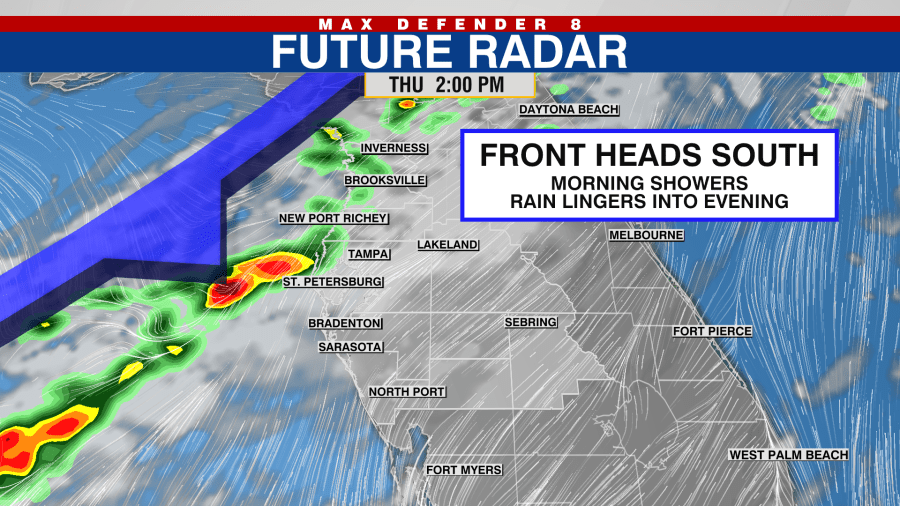
A cold front approaches and brings showers tomorrow night and Thursday morning. The front pushes south through the Tampa Bay Thursday, so scattered showers remain in the forecast into the evening.
Behind the front, we’ll get cooler and drier air. Highs will only be in the mid 60s Friday afternoon, and it’ll drop into the 40s Friday night.
It stays mostly sunny, crisp and cool through the weekend. The next rain chance returns for the middle of next week.