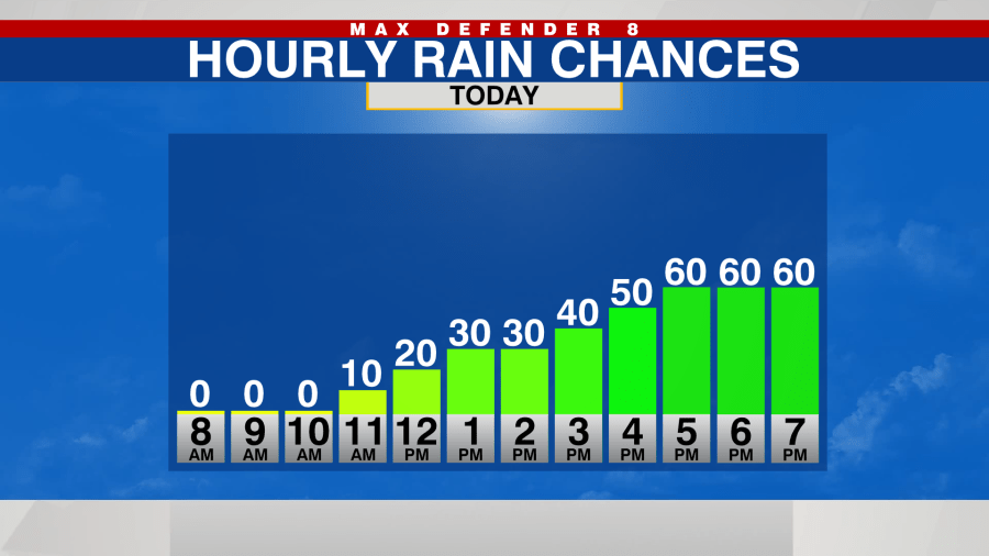
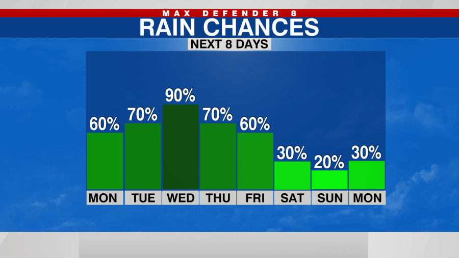
TAMPA, Fla. (WFLA) – While it will feel more humid today, there will be no direct impacts from Tropical Storm Idalia today. Temperatures climb into the low 90s with a 60% chance of afternoon and evening downpours.
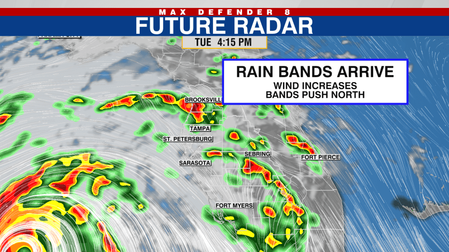
The rain bands from Idalia start arriving tomorrow afternoon as the system strengthens in the Gulf of Mexico.
Those bands will push from south to north, and wind gusts could reach 20-30 mph at times.
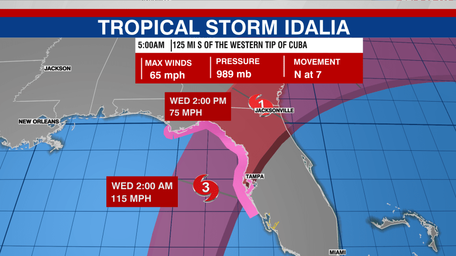
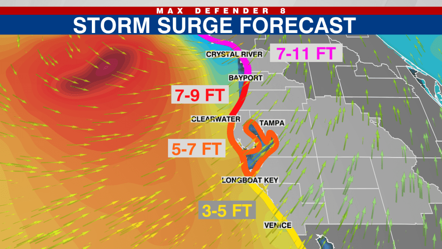
Idalia is expected to make landfall just north of the Tampa Bay area early Wednesday. Our strongest wind gusts will be overnight Tuesday and through Wednesday morning. An onshore wind flow combined with higher tides due to the super moon will lead to coastal flooding in many areas. Storm surge could reach 7-10 feet in Citrus & Hernando counties. The surge will be slightly lower for Pasco & Pinellas.
The storm races off the northeast after landfall Wednesday morning, and our wind quickly calms down. We are left with scattered afternoon storms Thursday and Friday, and it should be drier for the weekend.
Watch WFLA Now’s 24/7 coverage to stay up-to-date on Idalia. Get the latest on closings and weather conditions in your area on our Tracking the Tropics page.


