TAMPA, Fla. (WFLA) – Bands of rain wrapping around Idalia arrive this afternoon. The storms start in southern areas and push north through the day.
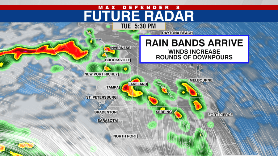
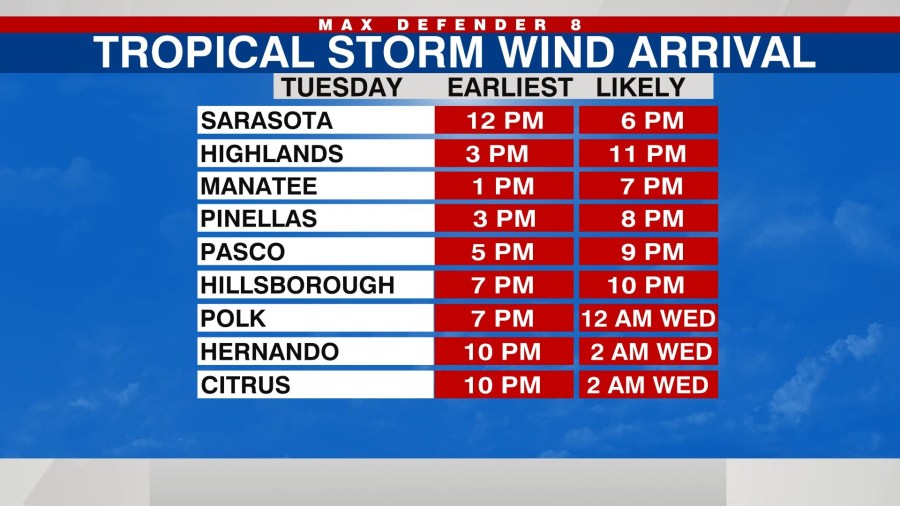
Wind speeds increase as the tropical system gets closer to us. Wind gusts could reach 40 mph late this afternoon in spots.
Between the storms, it will be hot and humid with highs in the low 90s.
The worst weather comes after sunset tonight as the storm passes just off our coast. Wind speeds could increase to 50-60 mph with rounds of torrential rain.
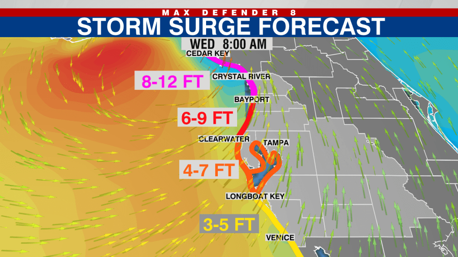
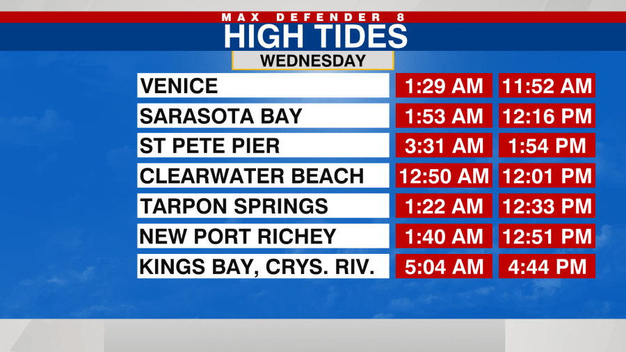
Once the storm pushes north, an onshore wind develops, and the potential for tidal flooding becomes a concern. The high tides Wednesday will be several feet above normal, and that could bring water into homes. The early high tide is before sunrise, and you may not be able to see the water rising.
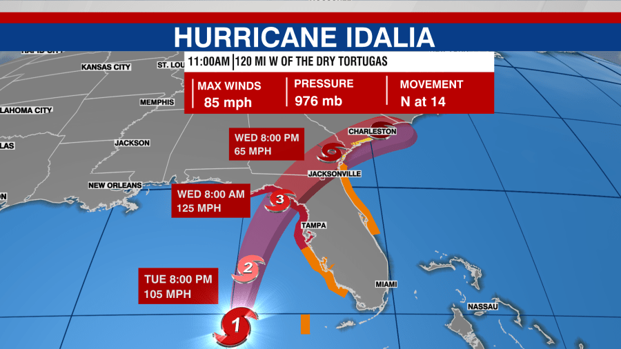
Idalia may make landfall in the Big Bend region of Florida as a Category 3 hurricane Wednesday morning, and then it heads to the northeast through north Florida and Georgia.
Even after the storm passes, the onshore wind will remain strong, and passing downpours are expected Wednesday afternoon through Thursday.
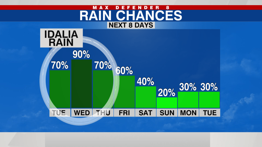
The rain chances drop significantly for the Labor Day Weekend.