TAMPA, Fla. (WFLA) – Today was hot! We topped out in the low 90s under partly cloudy skies. Showers and a few thunderstorms made their way across the state, entering our inland counties during the afternoon and growing as they drifted slowly towards our coastline during the evening.
The storms will cool us down as they drift slowly through, temperatures will cool down into the low 70s. The showers will push offshore after sunset.
Expect a humid and quiet night. Temperatures will be in the upper 70s and low 80s. The skies will clear out after midnight.
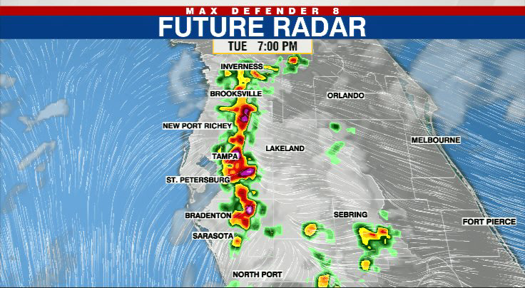
Tuesday looks similar, starting in the muggy upper 70s and warming quickly into the mid to low 90s by the afternoon hours. The rain chances will be similar in timing. The storms that develop after 3pm will push toward the Gulf of Mexico, and the strongest storms of the day will be near the coast around sunset. Then the storms push into the Gulf and quickly fade away as it begins to cool.
The rain chances are again at 50% on Wednesday. Each day the strongest storms come late in the day and near the coast.

The rain chance increases to 60% Thursday and Friday, and it remains at 60% this week. Even as the coverage of the storms increases, the timing stays the same. Most of the storms will be after 3pm and will continue until sunset.
No relief from the heat until the storms arrive. Highs reach the low to mid 90s every day.

In the tropics, we’re watching Potential Tropical Cyclone 2, which will most likely become Bonnie. The good news is that it will remain well to the south of us, impacting Central America next week.

Stay weather aware on the go with the free Max Defender 8 Weather app. You can also sign up to get daily forecast newsletters and weather alert emails sent to your inbox.