TAMPA, Fla. (WFLA) – Today was cloudy and cool, topping out in the mid to upper 60s. We saw light, pre-frontal showers moving through parts of our area, but not everyone will se the rain.
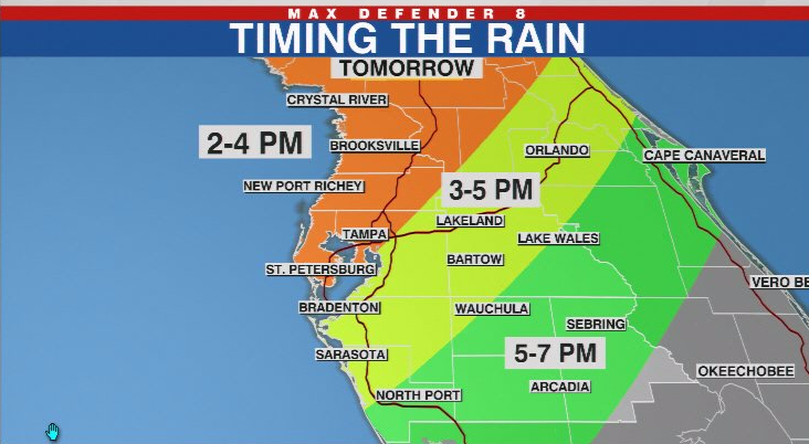
Tuesday starts out dry and windy, and the line of powerful storms arrives in the afternoon and evening.

There is a significant threat of damaging wind gusts, but we also have the chance of an isolated tornado. Hail is even a small threat.

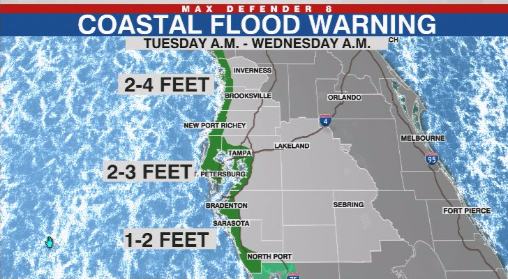
A strong onshore wind behind the front may cause coastal flooding in areas near the coast as the water from the Gulf of Mexico piles up at the shore.

We are cooler and drier for Wednesday, but we’re already tracking the next cold front. It does not look like this one will be as strong as it arrives Friday and passes early Saturday morning.


