TAMPA, Fla. (WFLA) – Scattered storms will continue through the evening hours with rain chances tapering off after 9 p.m. but a few downpours will be possible overnight. Clouds will linger and it will stay warm and muggy with lows in the mid-70s.

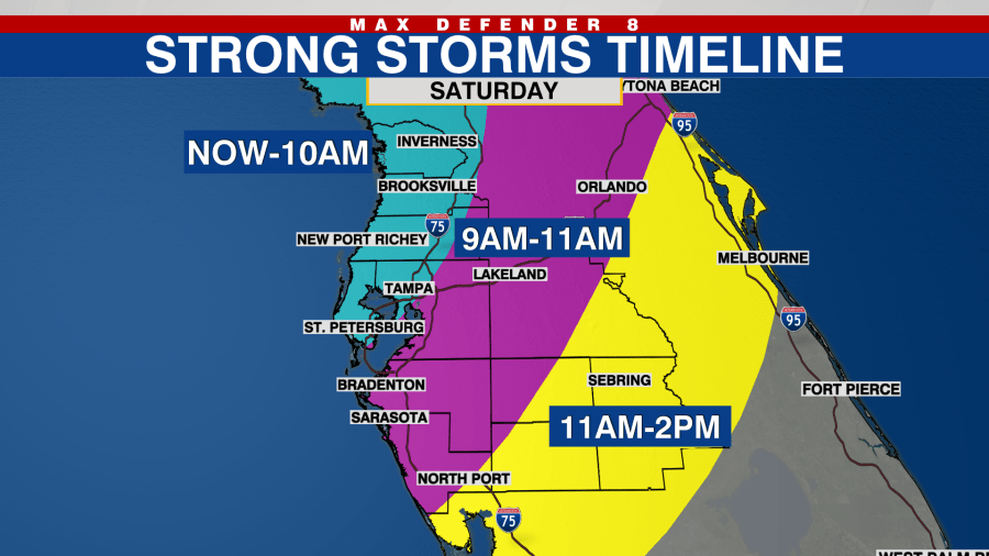
A cold front will approach Thursday. Rain chances will increase quickly in the morning with passing storms likely. A few storms could be on the stronger side with gusty winds.
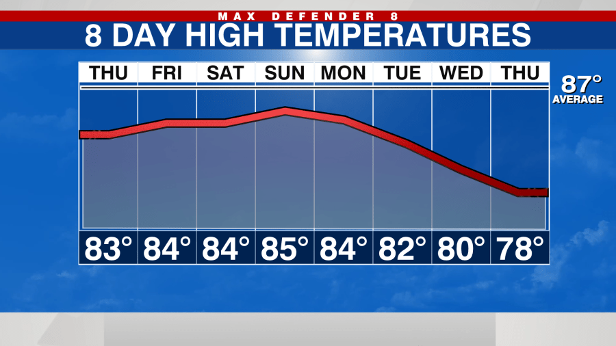
The bulk of the heavy rain will taper off and move south after 2 and 3 p.m. Clouds will linger and it will still be warm and muggy most of the day with highs in the mid-80d. Winds will slowly turn out of the north as the drier air begins to filter in.

Although it will be somewhat cooler Friday morning, the driest air will arrive Friday afternoon and stick around for the weekend.
High temperatures both Saturday and Sunday will be in the lower 80s. The low temperatures will be in the lower 60s. The humidity will be very low and that will make the mornings and evenings feel fall-like.
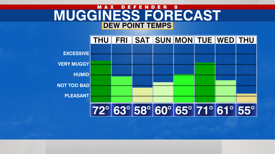
The mugginess and rain chances will return next week for a couple of days as another cold front passes. That second front will pass late Wednesday and early Thursday bringing another round of showers and thunderstorms.
Currently, forecast models bring in even cooler air for late next week behind that second front, but that could change.
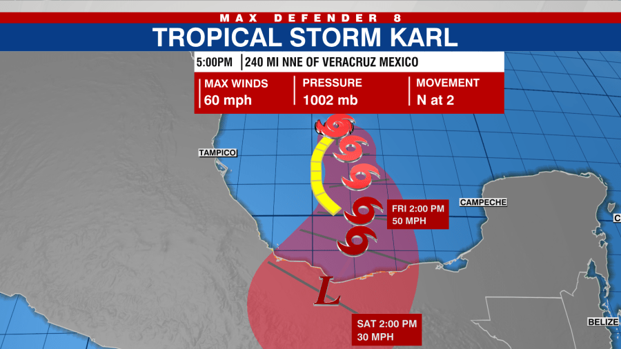
Tropical Storm Karl continues to meander in the southwestern Gulf of Mexico. This will not impact the U.S. as the cold front that will arrive tomorrow here in Florida, will push Karl south into Mexico.
The rest of the tropics remain quiet for now, but the season runs all the way through November.
Stay weather aware on the go with the free Max Defender 8 Weather app. You can also sign up to get daily forecast newsletters and weather alert emails sent to your inbox.