TAMPA, Fla. (WFLA) – We saw more record breaking heat this afternoon, we hit 90° at the airport, breaking our record high for today of 89°. The evening will be warm, slowly sinking down through the 80s and into the 70s. We’ll see partly cloudy skies and a bright moon overnight.
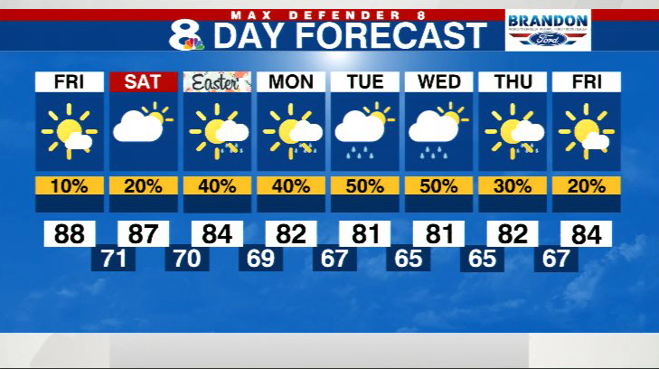
Friday begins in the comfortable upper 60s and low 70s. Expect another warmer-than-average, but not record breaking warm day. By the middle of the day we will be in the mid 80s. We should top out in the upper 80s, a degree or two shy of the high temperature records for the day. We expect a few isolated showers to pop up during the late afternoon and early evening hours over our inland counties.
Expect a steamy Saturday with highs in the upper 80s and a 20% chance of an afternoon shower.

A front stalls across our area on Easter Sunday, so the rain chance increases to 40%. It certainly won’t rain all day, but you should expect a passing shower or two during the day.

The front lingers Monday and an area of low pressure should develop along that front Tuesday. This will keep our weather “unsettled” for most of next week. Expect partly cloudy skies and off and on showers each day.
The extra clouds and rain help keep highs closer to average in the low 80s.