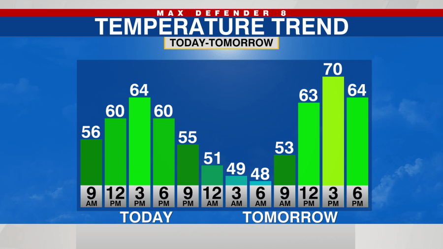
TAMPA, Fla. (WFLA) — Thanks to a weak cold front that moved through overnight, today was quiet and cooler. Temperatures only made it into the mid 60s this afternoon.
It’ll stay dry tonight but it will be chillier with temperatures dropping into the low in mid 40s for Wednesday morning.
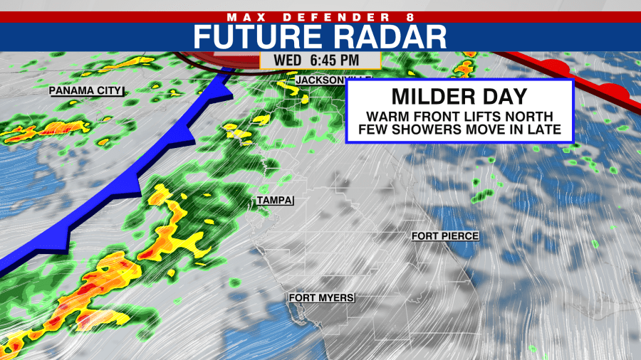
An active weather pattern is setting up over the next 8 days with the next storm system moving in late Wednesday and into Thursday with a few showers.
An even stronger front will come through on Saturday with the possibility of some stronger storms as it passes. Even before the rain arrives on Saturday it will be windy.
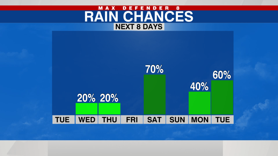
The storms clear out Saturday night and it will be quieter for Sunday before yet another system moves in on Monday and into Tuesday.
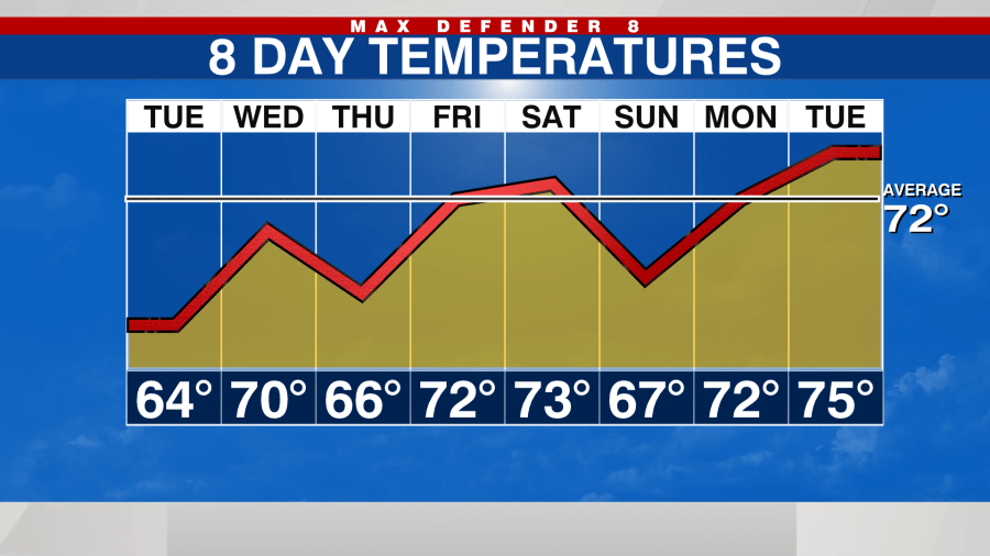
These fronts will lead to a roller coaster ride in temperatures over the next 8 days with highs staying at or below average in the mid and upper 60s on cooler days, and low 70s on milder days.


