TAMPA, Fla. (WFLA) Temperatures are still mild after yesterday’s cold front. There is a Dense Fog Advisory in effect with pockets of limited visibility expected through the mid-morning hours.
While it is dry this morning, a second cold front will pass through today bringing scattered showers, maybe even a few rumbles of thunder.
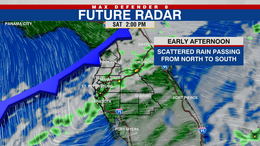
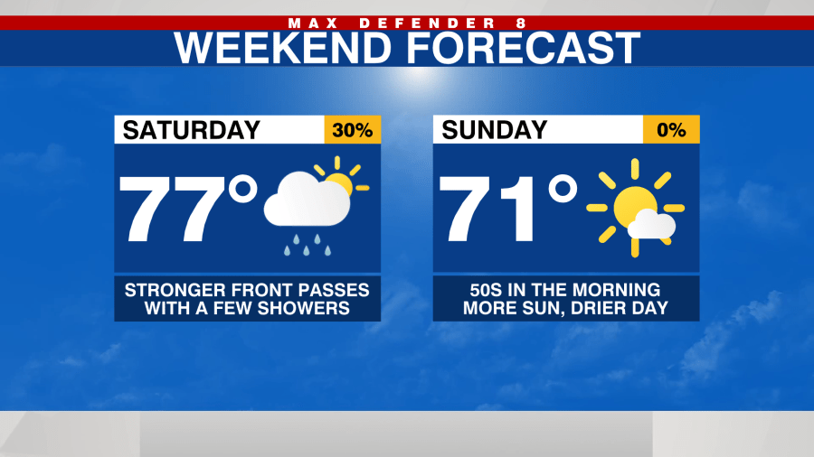
Today’s cold front is much stronger with a colder air mass moving in for the second half of the weekend.
Clouds will stick around while the front is passing today. Temperatures will stay mild with highs in the mid- to upper-70s. A line of showers will approach the Nature Coast by late morning an continue moving to the southeast through the early afternoon.

The rain will be far south by this evening and the colder air will begin to filter in. While the clouds mostly clear out overnight, temperatures will drop into low 50s north, and mid-50s along and south of I-4. Despite more filtered sun for Sunday, temperatures will struggle to warm up after the chilly start.
Highs on Sunday will be in the upper 60s in Citrus and Hernando counties. Temps will warm into the low 70s along and south of I-4. No rain is in the forecast Sunday.
The coldest temps will occur Monday morning with upper 40s and low 50s for lows.
A gradual warm up is in store through the middle of next week with highs back in the low 80s by Wednesday.


