TAMPA, Fla. (WFLA) – We’ve seen a few passing downpours, they are primarily over our inland counties this evening, they will fade or move east of us around sunset. Expect clearing skies and temperatures sinking down into the upper 70s overnight.
Saturday starts out around 78° and warms up quickly into the low 90s. Expect an isolated chance for an afternoon shower to pop up. Easterly winds develop, which changes the timing of our rain chances. Expect only a few late afternoon/early evening showers to push across the state and into our area.
Sunday looks similar, waking up in the mid 70s (that will feel pretty nice!) and warming up close to the mid 90s. We have isolated chances for a few showers during the late afternoon and early evening.
Monday trends a tad drier also, the easterly winds persist through most of next week, making for sunnier mornings, hotter afternoons, and a more defined round of showers and storms pushing across the state from the east coast of Florida.
The rain chances increase to 40% for most of next week. The typical summer pattern of morning sunshine and heavy late-day downpours will be in place.
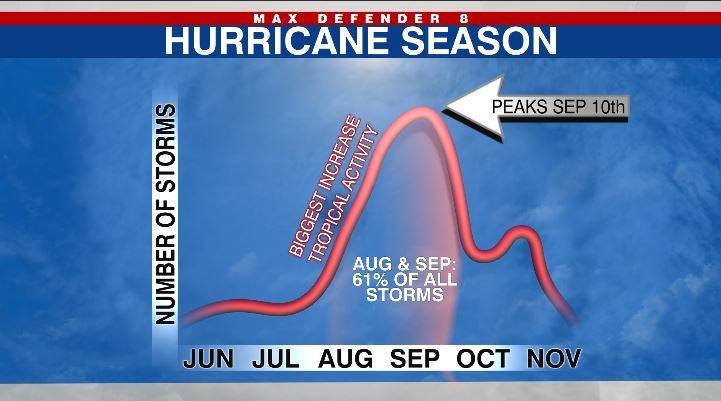
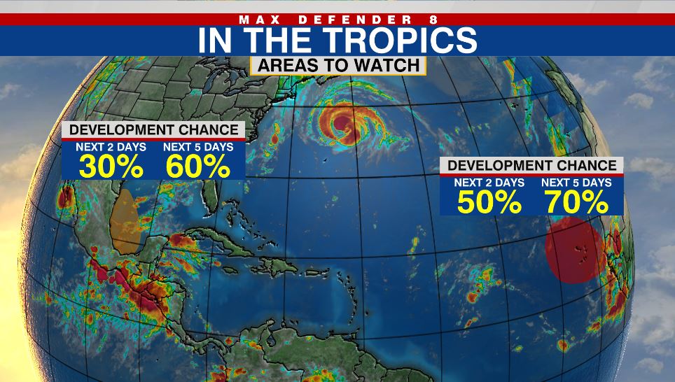
Today is the peak of hurricane season. We are tracking Hurricane Larry, but it is headed into the northern Atlantic and won’t bother the U.S. There are two other areas that may develop, so we are keeping a close eye on the tropics right now.