TAMPA, Fla. (WFLA) — Expect another warm, breezy day with highs in the low 80s. There’s a low chance for a quick passing shower but it will be mostly dry.

A strong cold front will pass through tonight with a line of showers and gusty storms. The line of storms will first approach Citrus and Hernando County from the northwest just before midnight. It will continue to move south through the early morning hours before sunrise Monday.
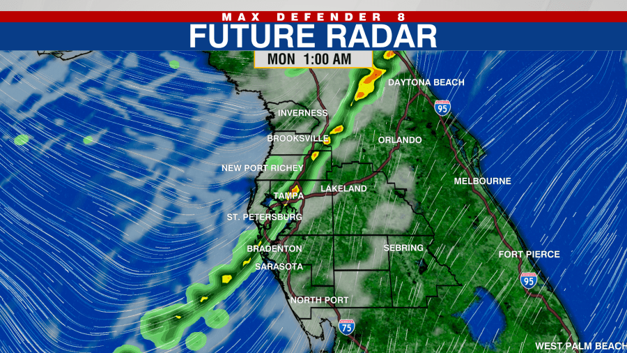
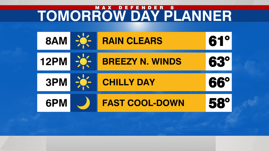
The rain will clear by 6 or 7 a.m. Monday, winds will switch direction and come out of the north as they bring in cooler and much drier air to the Tampa Bay area to start the work week.

Monday morning temps will be in the upper 50s and low 60s but it won’t warm up much in the afternoon. High temps Monday will be in the mid to upper 60s with a chilly breezy all day.
Monday night will be even colder with many spots dropping into the upper 40s for Tuesday morning. A gradual warming trend will begin Tuesday afternoon.

Temps will rebound nicely after that chilly start with highs in the mid 70s Tuesday afternoon.
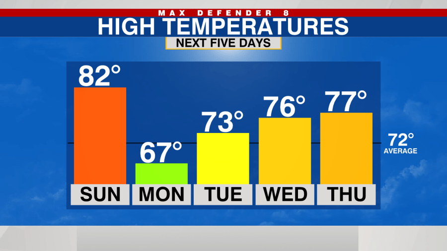
Another cold front comes through Friday with a chance for rain but not nearly as big of a cool down for next weekend.


