TAMPA, Fla. (WFLA) — Skies are mostly cloudy this morning and temperatures are mild. We’ll see more clouds than sun for most of the day keeping temperatures in the upper 80s along the coast and closer to 90° inland.
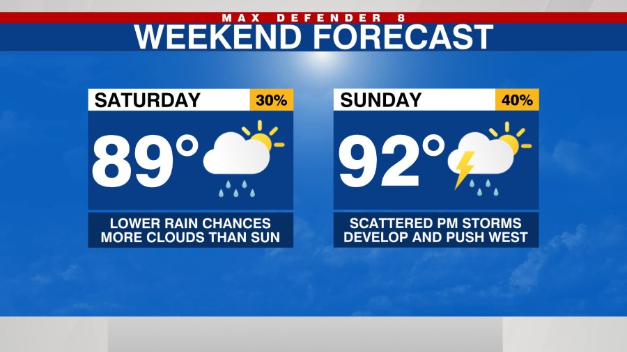
There’s a 30% chance for some light showers along the coast through midday then scattered showers and thunderstorms could develop this afternoon. However, rain chances are lower today than they have been the past couple of days and the coverage of rain should be less.
Expect to mostly dry out overnight with some clearing of the clouds. After a mostly dry start to Sunday, we’ll see a mixture of sun and clouds Sunday afternoon leading to warmer temperatures with highs near 92°.
Rain chance is will increase to a 40% for scattered showers and thunderstorms developing and drifting toward the coast in the evening. We’ll be in a relatively normal pattern as we head through the work week with rain chances between a 30 and 40% each day and highs in the low 90s.
The tropics remain active with hurricane Larry racing away from Newfoundland this morning. The National Hurricane Center is also tracking three other areas of possible development.
The closest to the United States is in the western Gulf of Mexico with a tropical depression likely forming Sunday or Monday. This will likely stay in the western Gulf of Mexico possibly impacting Mexico or Texas.
A vigorous tropical wave moved off the coast of Africa yesterday and has a high chance of developing into at least a tropical depression on Sunday.
There is another tropical wave that will come off the coast of Africa early next week and we’ll have a chance of developing as well.
While nothing is threatening the Tampa Bay area at the moment it is still very early in the hurricane season and we will continue to watch for any threats.


