TAMPA, Fla. (WFLA) – We’re in for a rough night, Tropical Storm Elsa is expected to reach Hurricane strength overnight, with 75 mph winds as it brushes out coastline. Official landfall is expected just north of our area, but we will still feel the worst of the storm. The storm itself is lopsided, all of the rain and wind is on the east side of the storm, which will impact our coastline.
From Egmont key north, we are under a Hurricane Warning, to the South of Egmont Key we are under a Tropical Storm Warning. Our entire area is under a Tornado Watch through 11pm, meaning we have all the elements needed for a tornado to spin up, and we may see a few on the rain bands moving onshore.
Winds will build this evening. We expect the worst of the winds between 25-45 mph between midnight and 4 a.m. Because our ground is so saturated, we may see toppled trees where the wind gusts are strongest.
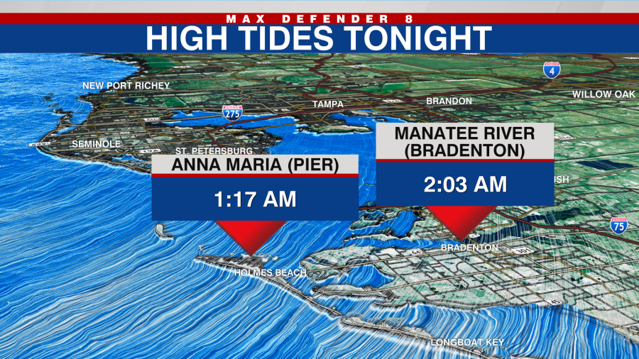
A Storm Surge Warning is in place along the entire coastline. Tides will run 2-4 feet, possibly up to 5 feet, higher than normal tonight. The high tide that will be impacted most will occur after midnight tonight.
A Flood Watch is also in place for heavy downpours and the already saturated ground. Rain totals could reach four to six inches in some spots, especially along the coast.
Winds will build overnight, especially in those outer rain bands. The sustained tropical storm force winds will start later tonight and continue into early Wednesday morning.
There is a low end threat for an isolated tornado as well since the entire area will be on the eastern side of the storm.
Once Elsa gets to our north by midday tomorrow, winds will subside and conditions will improve. Rain will taper off, and it stays breezy. Eventually the clouds will break up as well.
By Thursday and Friday, we are back to a typical summer pattern of afternoon thunderstorms.


