TAMPA, Fla. (WFLA) — Another chilly night is in store for Tampa Bay with temperatures dropping quickly this evening and into the upper 40s by Saturday morning. Skies will be clear and winds be light overnight.
After the chilly start, temps will warm quickly and a beautiful day is in store with highs in the low 70s. We’ll see a few more patchy clouds develop but no rain is in the forecast.
Sunday morning will be milder with lows in the upper 50s. Temps will warm into the mid to upper 70s by the afternoon and we’ll see more clouds. Winds will be a little breezier out of the south.
A front will be moving into the southeast US on Sunday. The rain associated with the front will hold off until Sunday night but there is a 10% chance for a shower or two Sunday afternoon.
A line of showers will pass through Sunday night and early Monday morning. Much colder air will arrive throughout the day Monday and temperatures will be below average for the first half of the week.
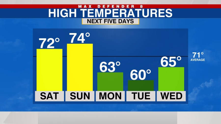
We’ll warm up again at the end of the week before the next front approaches. There are question marks on when that front will arrive and if it will even move all the way through. Check back often for updates.


