TAMPA, Fla. (WFLA) – We’ll enjoy a couple warmer days midweek before a BIG cool down arrives before Christmas thanks to a strong cold front.
After a gorgeous Tuesday, temperatures tonight will get a little chilly once again. Mostly clear skies are expected overnight with low temperatures around 50 degrees. We’ll enjoy plenty of sunshine Wednesday with high pressure overhead. Afternoon high temperatures will climb above average into the mid 70s.
Most of Christmas Eve will be dry and warm before that strong cold front arrives during the evening hours Thursday. Expect more rain and thunderstorms during the evening lasting overnight and into early Christmas morning. Temperatures will plummet in the wake of this potent front as colder air crashes in.
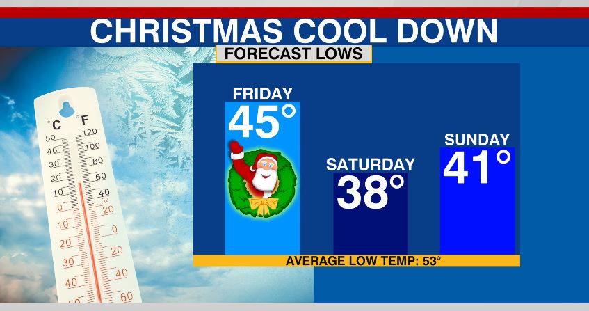
Low temperatures by Saturday morning will drop into the 30s. Northern parts of the Tampa Bay area will see temperatures drop below freezing. Temperatures will eventually climb back to average by the early part of next week.


