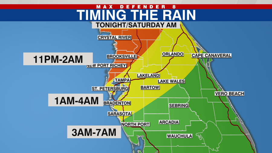
TAMPA, Fla. (WFLA) — After a warm and muggy day, changes arrive again tonight. If you’re going to be out and about this evening, we have the possibility of some showers developing. They will increase in intensity and coverage with the potential of some strong storms overnight as a cold front passes through our area.
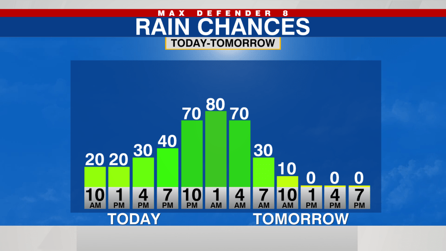
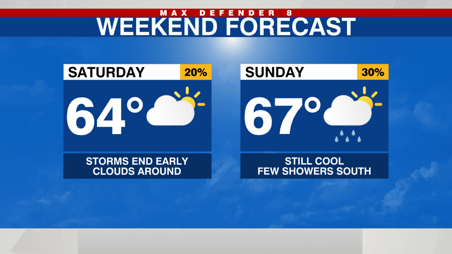
Most of the rain will be gone by the time you wake up Saturday morning.
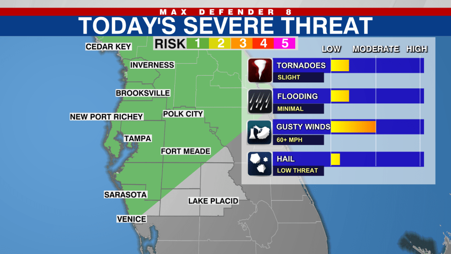
The Storm Prediction Center has placed most of us in a “Marginal” or 1 out of 5 on the risk scale for severe storms. The biggest threat will be from damaging wind gusts, but an isolated tornado is not out of the question.
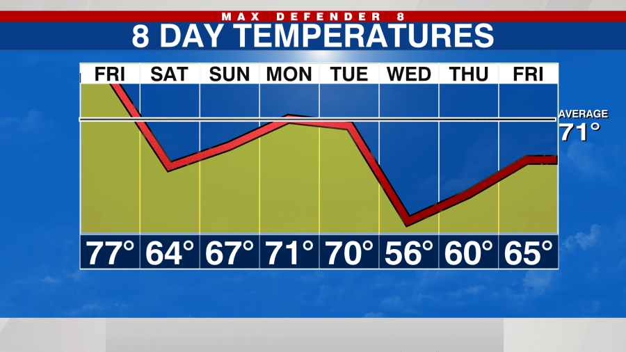
Clouds linger around on Saturday as cooler air arrives. Temperatures will not climb up much during the day. Highs stay in the mid-60s.
Sunday will also be cool in the 60s, and some rain will develop south of I-4 near the stalled cold front.
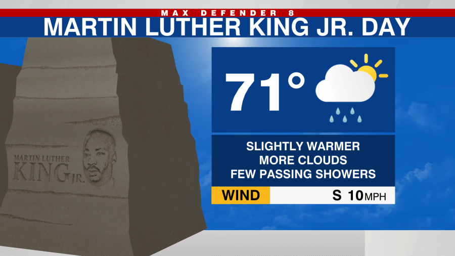
We are already tracking the next storm system. It keeps a few showers in the forecast for MLK Jr. Day, but it will also be warmer in the low 70s. You’ll want to bring a poncho to the Bucs game Monday night just to be safe.
The front pushes through Tuesday with a 60% rain chance, and we have significantly cooler air arriving for the middle of next week.