TAMPA, Fla. (WFLA) – Today was hot & steamy, with temperatures topping out in the mid to upper 90s. Showers drifted across the state towards the Gulf this evening. The showers and storms will build in intensity and coverage as they enter our coastal counties. We expect heavy downpours and strong, gusty winds within the strongest of this evening’s storms.
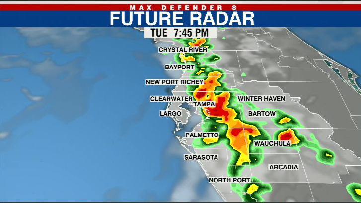
Showers eventually drift into the Gulf of Mexico, and it clears out overnight. Lows will be in the upper 70s.
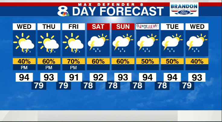
Similar conditions expected for Wednesday with highs in the low-mid 90s and a 40% chance of late-day storms. Once again, those storms will push toward the coast.
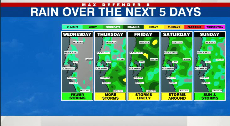
This typical summer pattern remains in place through the weekend. Expect morning sunshine and a good coverage of afternoon and evening storms each day. Highs remain the low 90s.

Potential Tropical Cyclone Two is developing off the coast of South America. The system will remain on a track to the west and will not get close to the U.S. It may reach hurricane strength before it makes landfall in Central America late this week.
Stay weather aware on the go with the free Max Defender 8 Weather app. You can also sign up to get daily forecast newsletters and weather alert emails sent to your inbox.