TAMPA, Fla. (WFLA) – We started off with sunshine, but building clouds and then inland storms built up. The showers may linger well into the evening hours, possibly drifting back out towards the Gulf.
Our weather pattern turns much soggier for the end of the week and into the weekend.
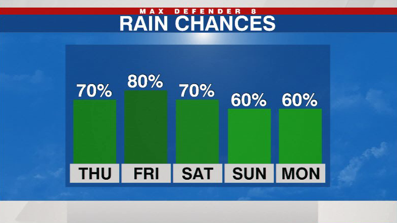
An onshore wind pattern is setting up along with increased moisture across Florida. Watch for showers and storms to start earlier in the day tomorrow.
The rain chance increases to 70%, and extra clouds around help hold highs near 90 degrees.

Friday should be the wettest day with an 80% chance of off and on downpours at anytime. The onshore wind pattern keeps the chance for morning showers in the forecast into early next week.
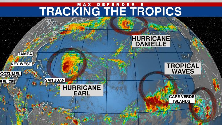
We now have two hurricanes in the Atlantic with Danielle and Earl. Danielle should weaken in the northern Atlantic, but Earl may become our first major hurricane of the season as it tracks near Bermuda. It should not impact the U.S. Two more tropical waves in the eastern Atlantic have the chance to organize as they head west.
Stay weather aware on the go with the free Max Defender 8 Weather app. You can also sign up to get daily forecast newsletters and weather alert emails sent to your inbox.


