TAMPA, Fla. (WFLA) – As Hurricane Ian strengthens and heads north into the Gulf of Mexico today, we will start to feel some effects.
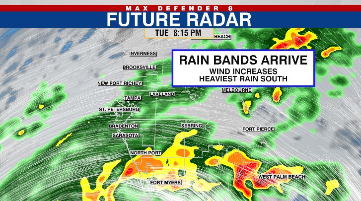
Winds increase through the day as a few northern bands of rain start to arrive in areas south of I-4 this afternoon. Today’s winds will come from the east and push toward the Gulf of Mexico. That means we may see lower than normal tides this evening.

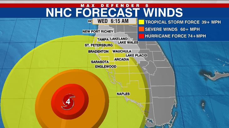
The rain coverage increases this evening as Ian continues to push north. By tomorrow morning, areas south of I-4 may start to feel tropical storm force winds, and the rain becomes more widespread.

Ian slows down off our coast tomorrow, so that means we’ll see tropical conditions for even longer. They should last through Thursday depending on the exact track of the storm.
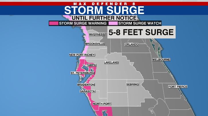
Hurricane Warnings and Storm Surge Warnings are in place for much of our coastline. The surge of water will begin as the eye gets just to the north of an area, and the winds start coming from the southwest. That wind direction pushes water from the Gulf of Mexico into bays and rivers and onto land.

Conditions will improve on Friday.
Stay weather aware on the go with the free Max Defender 8 Weather app. You can also sign up to get daily forecast newsletters and weather alert emails sent to your inbox.


