TAMPA, Fla. (WFLA) – We start out mostly sunny and warm up quickly. Highs reach the low 90s this afternoon.
The first showers develop in the early afternoon, but the majority of the heavy rain will be east of I-75 later in the day. Some of those storms will linger past sunset, so you may need an umbrella for Friday evening activities.
Chief Meteorologist Jeff Berardelli tracked afternoon storms as heavy rains swept across parts of Tampa Bay.
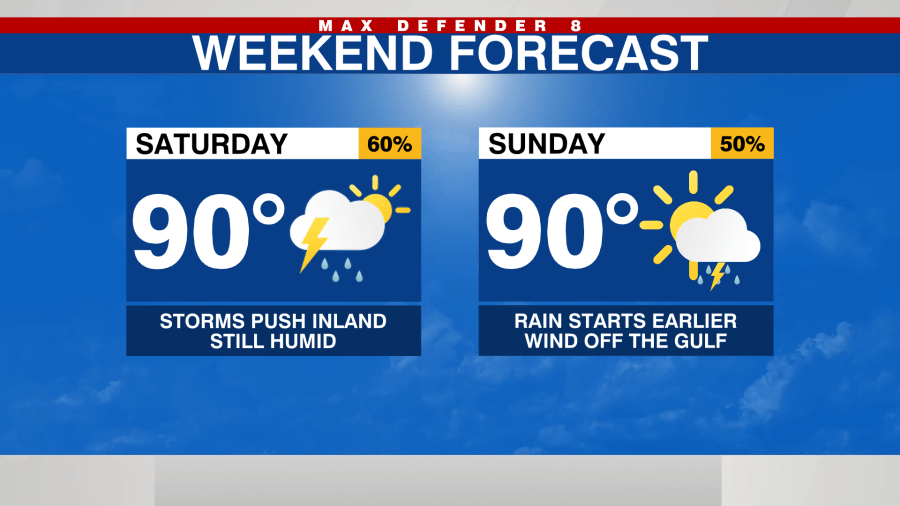
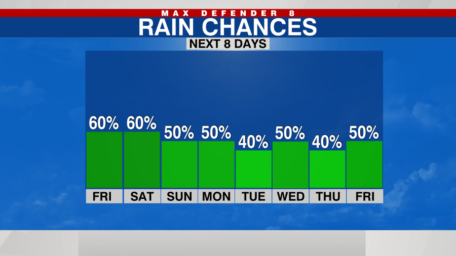
It’s a similar day tomorrow with a 60% chance of late-day storms, mostly in the center of the state.
The pattern is slightly different for Sunday. With a stronger breeze off the Gulf of Mexico, the showers start a little earlier in the day, but they also end earlier. Most of the downpours will be over before sunset. Highs stay near 90 degrees.

We may see a slight dip in the rain chances Tuesday with some drier air trying to push south. Otherwise, scattered storms expected each afternoon.

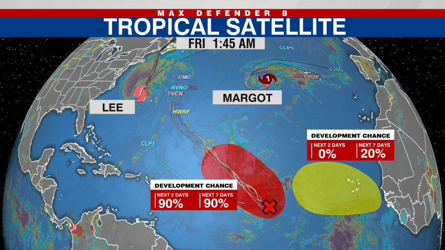
Hurricane Lee is still expected to head north toward the Canadian Maritimes and bring high wind and waves to New England. Hurricane Margot remains a “fish storm,” and a tropical wave is likely to develop into a tropical storm in the central Atlantic. The next name on the list is Nigel.


