TAMPA, Fla. (WFLA) — Today was sunny and hot. we topped out in the mid to low 90s. A few storms fired up in the afternoon hours, but it was in the early evening that the bulk of the storms boiled over our inland and southern counties.
Very light overall winds mean slow moving (if they move at all!) storms. As a result, the rainfall is feast or famine- meaning those under the storms get hammered with rain and those just a few miles away miss out on the rain all together.
The last of the storms fade out around 10 p.m. and the skies will slowly clear out overnight. Temperatures will hover in the upper 70s and low 80s.
Wednesday starts out with sunshine and warms very quickly. We will top out in the mid to low 90s. A few isolated showers will develop along the coast early in the afternoon and move inland with the sea breeze. There’ll be a 50% rain chance through 10:00 p.m. before storms diminish after sunset. The heaviest rain will be just east of I-75 before sunset.
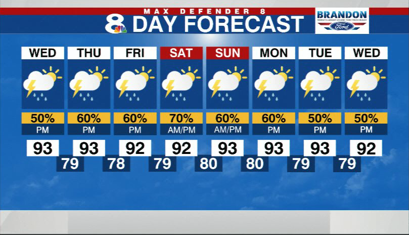
Expect slightly better rain chances in the forecast for the rest of the week. The rain timing will be later again on Thursday.
Friday and Saturday’s rain chances are more spread through the early afternoon, not just confined to the later afternoon and evening hours.
The National Hurricane Center is still tracking three tropical waves moving across the Atlantic Ocean, giving two of the systems a 20% chance of developing over the next 5 days. The area moving towards the Lesser Antilles and the storms near the coast of Africa are the two areas with a 20% chances to develop. In between is another area that now has a 0% chance to develop.


