TAMPA, Fla. (WFLA) – Today started out with lovely sunshine and warmed nicely. Mid day showers drifted onshore from the Gulf and made their way inland. This evening things are much quieter, with temperatures in the 80s and only a few stray showers.
Tonight the clouds linger for the first part of the evening. The bright moon will peek between the clouds and temperatures will be in the 70s.
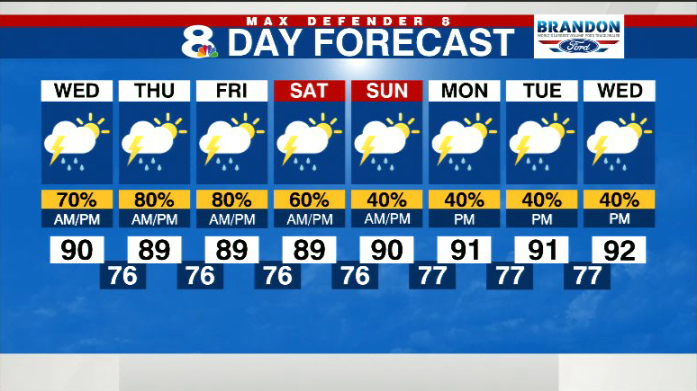
Wednesday starts out sunny, with showers offshore. Most of those showers will remain offshore, but an isolated downpour or two may make its way onto our coastline. As temperatures warm into the low 90s, the rain chance increases to 60% in the late afternoon and evening. Some storms even linger past sunset before coming to an end. The chances for rain are expected to be mainly inland.
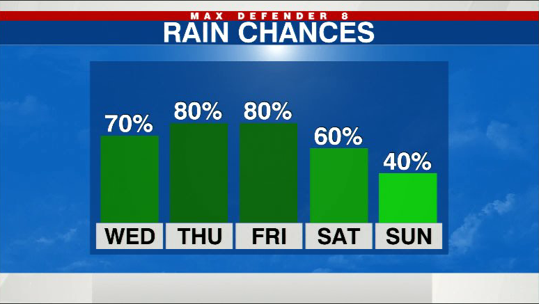
Highs return to the upper 80s-near 90 degrees Thursday. We should get another round of late-day downpours on Thursday as well.
Scattered afternoon thunderstorms are in the forecast through the weekend. There will be a good coverage of downpours, so make sure to check the radar before heading out.
As we return to “normal” rain chances next week, temperatures also return to average.
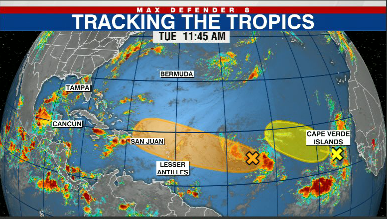
We are tracking two tropical waves right now in the Atlantic. One has a 40% chance of developing as it heads west toward the Bahamas.
Stay weather aware on the go with the free Max Defender 8 Weather app. You can also sign up to get daily forecast newsletters and weather alert emails sent to your inbox.


