TAMPA, Fla. (WFLA) — A few scattered showers will form this evening but they will not last long and dissipate by 9 p.m. Most spots will stay dry and mild with a slow drop in temperatures.
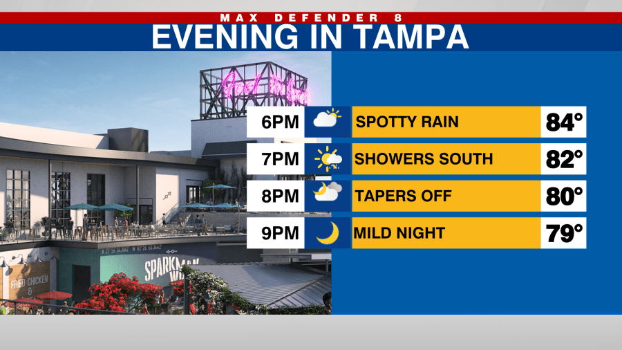
Skies will clear out and temps will drop to near 70 degrees along and south of the I-4 corridor. Temperatures will be cooler north of I-4 with morning temps in the upper 60s.
Saturday will be similar to Friday, warm and somewhat muggy afternoon along with a 30% rain chance. Spotty storms will develop after 2 p.m. Highs will be in the upper 80s.

Sunday will be a bit nicer. A more pleasant start is expected with slightly lower humidity and temperatures in the upper 60s. It’ll stay dry Sunday with just a few clouds developing.

A potent cold front will approach late Monday and pass through on Tuesday with showers and storms expected both days. Monday’s rain will be later in the day with storms possible along the front as it passes through on Tuesday. Rain clears out Tuesday night and the drier and much cooler air will rush in.
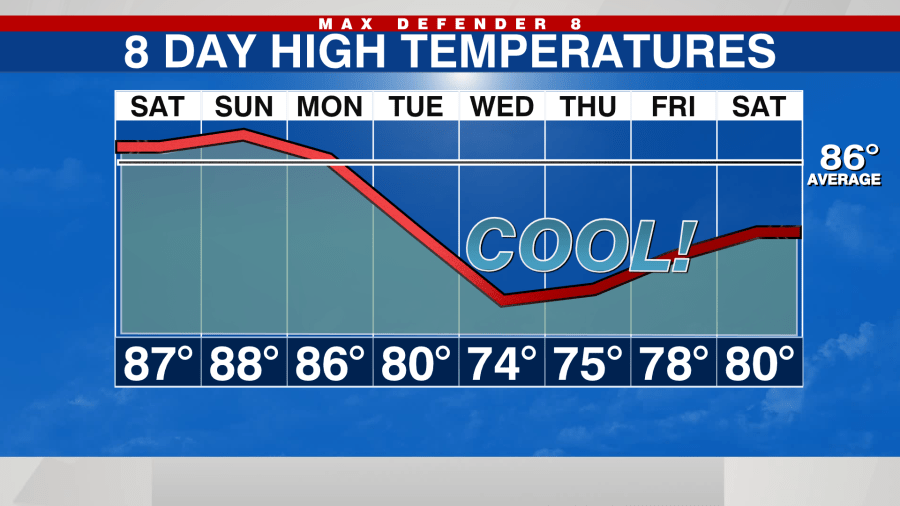
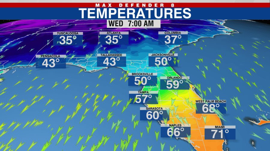
This could be the first time temps drop into the 50s in Tampa this season. The cooler air will stick around with lows in the 50s and highs in the 70s Wednesday through Friday. These would be temperatures about 10 degrees below average.
The tropics remain relatively quiet. Tropical Storm Karl is weakening as it moves back toward Mexico. There is a tropical wave the National Hurricane Center is giving a 10% chance of developing over the next five days but it should not impact the United States.
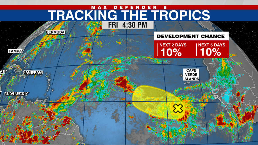
Hurricane Season does run through November.
Stay weather aware on the go with the free Max Defender 8 Weather app. You can also sign up to get daily forecast newsletters and weather alert emails sent to your inbox.