TAMPA (WFLA) – The National Hurricane Center expects a disturbance in the Gulf to become organized Thursday.
For now, they have deemed the system Potential Tropical Cyclone Two. This allows them to issue Tropical Storm Watches and Warnings as well as a forecast cone for the potential impacts.
Only slow strengthening is expected through the next 36 hours. While the storm is over warm gulf waters, the lack of a well defined center and presence of wind shear aloft will prevent rapid intensification. However, after Thursday, the center of circulation should be more defined and wind shear will weaken. Quick intensification is possible before landfall. The official forecast from the National Hurricane Center is for the disturbance to strengthen into a category 1 hurricane before landfall. The current cone extends from the eastern portion of Louisiana to the eastern coast of Texas.

Tropical Storm and Storm Surge Watches are in effect for portions of the Louisiana coastline. These may be upgraded to Hurricane Watches and possibly Warnings as the system moves closer.
An Air Force Reserve unit reconnaissance aircraft is scheduled to investigate the disturbance today at 2 pm. If they find a well defined central area of lower pressure, the system will be classified as a tropical depression. If sustained wind speeds reach 39 mph near the center, the storm will be upgraded to a tropical storm and given the name “Barry.”

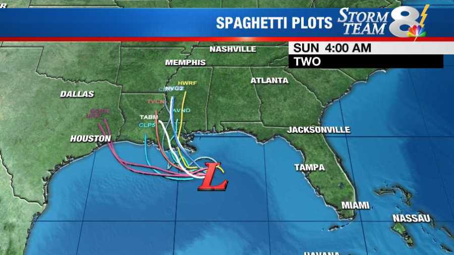
Models are all in good agreement on the storm slowly drifting west in the Gulf over the next 24 hours before moving northwest toward the Gulf Coast. Until the storm moves far enough west, Tampa will see continue to see widespread showers and storms. The showers and thunderstorms will remain in the forecast through the end of the week as an onshore flow sticks around.
The timing of the turn back to the north will determine more specific impacts. An earlier turn back to the north would result in a likely landfall in Louisiana but a later turn, the farther west landfall will be.

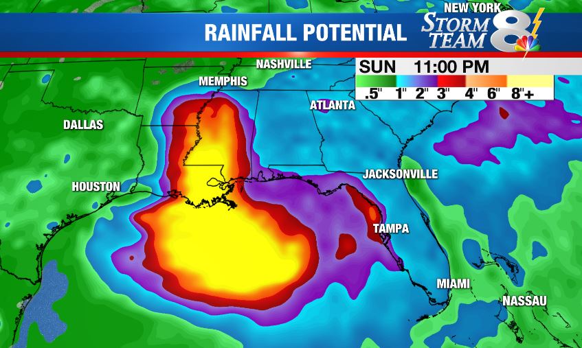
The northern Gulf Coast should continue to closely monitor the development of this system. Heavy rain will be likely from the Florida panhandle to the Texas Coast as the system moves ashore. 10 to 15 inches of rain are possible near the center of the storm, with locally higher amounts. Tropical storm or hurricane conditions are possible by Friday.
The National Hurricane Center warns that tropical storm or even hurricane force winds are possible in portions of Louisiana, Mississippi and the upper Texas coast by Friday.


