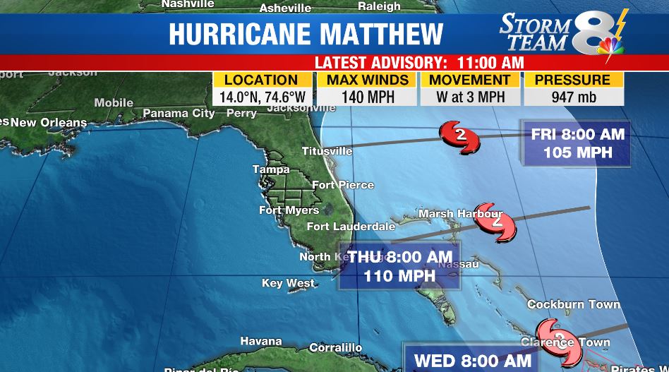
KINGSTON, Jamaica (AP) – Hurricane Matthew has been downgraded to a Category 4 storm as it continues roaring across the Caribbean Sea on a course that puts Jamaica, as well as parts of Haiti and Cuba, in the path of its potentially devastating winds and rain.
Jamaicans are bracing for a visit from one of the most powerful Atlantic hurricanes in recent history.
Hurricane Matthew, with winds of 150 mph, is roaring across the Caribbean Sea on a course that also puts parts of Haiti and Cuba in danger. Hurricane warnings have been issued for Jamaica and much of Haiti.
Matthew is expected to bring heavy rainfall especially to the eastern tip of Jamaica and higher elevations, which could trigger flooding and landslides. Forecasters say rainfall totals could reach 10 to 25 inches, with isolated maximum amounts of up to 40 inches in southwestern Haiti.
WFLA Storm Team 8 Meteorologist Ian Oliver said about Matthew:
Matthew will weaken some as it interacts with the land and some of the higher terrain of eastern Cuba and western Hispaniola over the next few days. The storm is expected to re-intensify in the Bahamas. With the east coast of FL still in the cone of uncertainty for the long term forecast track, it’s still far too early to rule out Florida impacts from Matthew. We’ll be watching this storm very closely for the next several days.

As of 11 PM EDT, the storm was centered about 360 miles (580 kilometers) southeast of Kingston, Jamaica. It was moving north-northwest at 7 mph (11 kph).
Hurricane-force winds extended outward up to 25 miles (35 kilometers) from the center and tropical-storm-force winds extend outward up to 205 miles (335 kilometers).
A turn toward the north is expected on Sunday. On the forecast track, the center of Matthew would move across the central Caribbean Sea Sunday, and approach Jamaica and southwestern Haiti Sunday night and Monday.
Forecasters say some fluctuations in intensity are possible this weekend, but Matthew is expected to remain a powerful hurricane through Monday.


