LAKELAND, Fla. (WFLA) – As hurricane season gets more active, the National Oceanic and Atmospheric Administration (NOAA) is expanding its ability to monitor storms from above, inside and underneath them.
The Lakeland-based Hurricane Hunters have been flying specially-equipped P-3 planes into storms to collect data used for forecasting by the National Hurricane Center. But those planes have humans in them and there are some areas too dangerous for them to go.
In recent years, NOAA has been growing a three-pronged drone program: ocean gliders underwater, Saildrones on the surface and now, drones in the air.
“We have the uncrewed aircraft system, the Area I Altia 600 which has been tested successfully and we certainly hope to deploy in a storm within the next week when the opportunity arises,” said CAPT Philip Hall, director of the NOAA Uncrewed Systems Operations Center.
CAPT Hall expects the airborne drones to be deployed during the major storm headed for Florida next week.
“It is pushed out of this tube [in th P-3] and then a parachute deploys and then the wings pop out and the engines start. All this has to happen perfectly,” he said.
The drones are directed to areas that are unsafe for people to go, collecting data on conditions including wind and temperature. They are operated by a pilot in the P-3 and can stay in flight for several hours. These drones are not recovered once they fall into the ocean.
“Its mission is to fly in the boundary layer of a tropical storm which is below 5,000 feet, usually down below 1,000 feet sometimes,” said CAPT Hall.
Another area of interest for scientists is where the ocean meets the air.
“They’re collecting that data, that really critically important data at the air/sea interface and that’s a previously unmonitored area from within hurricanes. You just haven’t been able to get that,” said Matt Womble, director of ocean data programs at Saildrone.
Saildrone has added two uncrewed hurricane-specific vehicles to its fleet, making seven Saildrones in the Gulf of Mexico and Atlantic Ocean.
They are 23-feet long and are equipped with a specially-designed hurricane wing that floats on the surface of the water. Like buoys, they collect data on weather conditions, but unlike buoys, they are mobile and can follow the storm however scientists see fit.
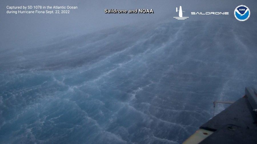
Womble said his company’s work has already helped scientists learn more about how the water’s salt level can affect the intensity of the storm. The Saildrones also have cameras, which transmit video from the surface of the ocean.

During Hurricane Fiona, a Saildrone captured on video its battle with 50-foot waves and 100 mile per hour winds.
“It really demonstrates in live terms just how violent it is, just how violent these systems are,” said Womble.
According to CAPT Philips, the information gathered from the drones is passed on to the National Hurricane Center but not used for forecasting yet, though that is the plan for the future.


