TAMPA, Fla. (WFLA) — The mugginess has returned this morning and temperatures are mild. Most spots are in the upper sixties to near 70°. We will warm up quickly this morning and temperatures will approach record highs this afternoon.
Expect low to mid 80s near the coast with mid to upper 80s east of I-75. We’ll see a mixture of sun and clouds and rain chances are less than 10% inland. Tonight we stay quite mild with lows in the upper 60s.
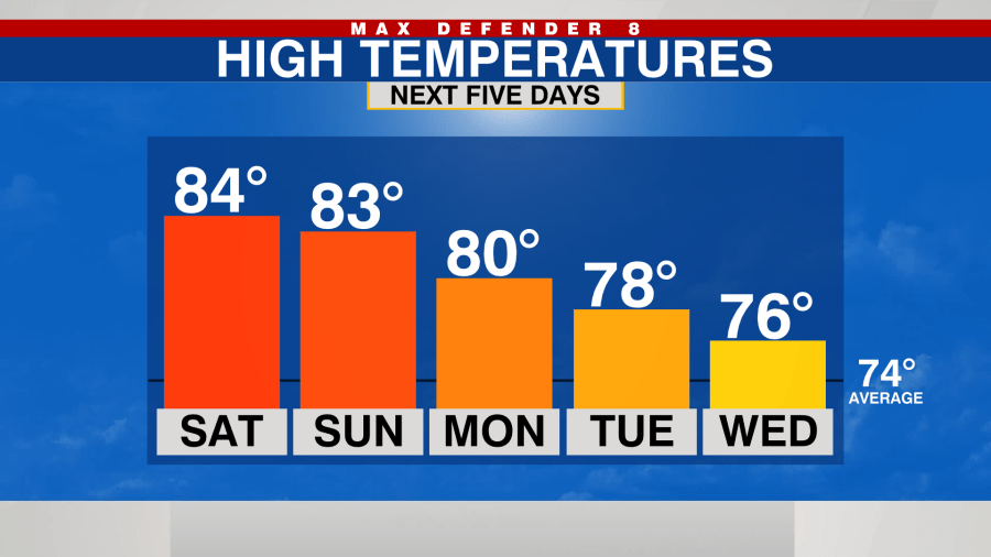
Another warm one expected for Sunday with highs in the low to mid 80s across the board. We’ll see a mixture of sun and clouds with another less than 10% chance for an isolated shower inland.
We stay warm and mostly dry on Monday.
A couple of cold fronts will approach next week. The timing and strength of these fronts are still uncertain. We will likely see a few showers as each one of these arrive.
It will also bring our temperatures out of the 80s for the middle and end of the week, closer to average in the mid 70s.
The second front looks stronger and possibly arrives on Saturday period temperatures could cool down significantly behind that front.


