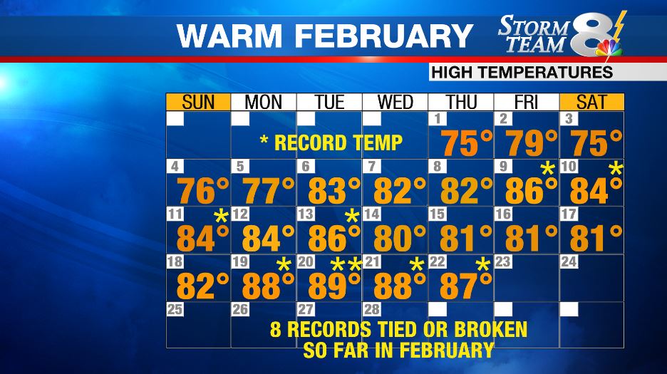
TAMPA (WFLA) – Based on the current forecast for the rest of the month, February 2018 will likely go down as the hottest February on record for the Tampa Bay area.
A large area of persistent upper-level high pressure has been the culprit. This feature sitting off of Florida’s east coast has acted as a blockade, keeping colder air locked across the northern and western United States. This a pattern that is more typical of mid-April.
As a result of this stagnant weather pattern, numerous cities across the Southeast U.S. have experienced record temperatures.

As of Feb. 23, Tampa International Airport hasn’t reported a single day with a high temperature that was below average. Eight days saw temperatures that matched or exceeded the daily record high temperature.
The warm spell has caused flower buds to bloom and pollen levels to rise. This is likely the reason why you may be finding yourself sneezing a bit more often.
This dominant area of high pressure will persist through the end of the month. This means more of the same; warm temperatures will very little rainfall.
However, it does appear as though this pattern will finally change as we move into March. Long-range forecast models indicate that this upper-level high pressure are will gradually weaken and erode.
This should allow cold fronts to move farther south bringing cooler air. Most of the state will likely begin feeling this reprieve from the warmth in time for the first full week of March.


