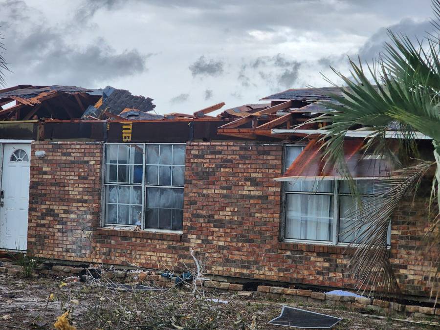
PANAMA CITY, Fla. (WMBB) — Severe storms charged through the Florida Panhandle during the early morning hours of Tuesday, January 9, 2024.
Supercell thunderstorms developed ahead of a line of storms in association with a cold front. Two supercells traveled northeast from the Gulf of Mexico, one through Walton County into Holmes County and another from Bay to Calhoun and into Jackson County.
The line of storms that came in following the supercells produced damaging wind gusts up to 80 mph and more isolated tornadoes.

The National Weather Service has had teams in the field surveying damage across the Panhandle since Wednesday. So far, they have been able to confirm six tornadoes in a total of three different counties: Bay, Jackson and Walton.
Survey work will continue today to include portions of northwest Jackson County just south of Graceville. Additionally, surveys will be ongoing in northern Bay County from Deer Point Lake to Fountain. The ratings and reports from these areas are expected by the end of the day.
The following data has been compiled from National Weather Service’s investigations of storm damage, confirming tornadoes or straight-line winds from the event. Their findings are preliminary and may be updated as more information is gathered.
Bay County
Lower Grand Lagoon
- Rating: EF-3
- Estimated Peak Winds: 140 mph
- Path Length: 5.22 miles
- Path Width: 400 yards
- Started 1 mile southeast of Biltmore Beach and lifted after crossing West 23rd Street in Panama City

Storm Survey:
“A tornado moved onshore Panama City Beach in the Lower Grand Lagoon area along Spyglass Drive. Significant damage occurred to several homes, including the complete destruction of one
beachfront home. The damage at this location was determined to support an EF-3 rating. Significant damage to homes and businesses continued as the tornado moved northeast across and along Thomas Drive where two apartment building were heavily damaged. EF-3 damage was again noted at a large boat storage facility which suffered significant structural failure. The
tornado continued northeastward across Grand Lagoon and through the Bay Point Golf Club, causing additional damage to homes, before crossing Saint Andrew Bay. The damage in Panama City, after crossing the bay was more sporadic and less intense, supportive of EF-1 intensity. The tornado appears to have dissipated shortly after crossing West 23rd Street. Additional adjustments may be made to the track as more data is gathered and analyzed. Thanks to Bay County Emergency Management for assistance with the damage survey.”
Lower Grand Lagoon – Satellite
- Rating: EF-0
- Estimated Peak Winds: 70 mph
- Path Length: 0.22 miles
- Path Width: 50 yards
- Started and ended in St. Andrews State Park

Storm Survey:
“Likely satellite vortex of parent EF-3 tornado just to the west made landfall at the western edge of St. Andrews State Park. Only very minor damage to a few tree limbs and an antenna were reported by park management. The tornado was confirmed via videos on social media.”
Lynn Haven/Deer Point Lake
- Rating: EF-2

Walton County
Defuniak Springs
- Rating: EF-1
- Estimated Peak Winds: 90 mph
- Path Length: 0.35 miles
- Path Width: 200 yards
- Started at the Defuniak Springs Airport and lifted one mile north/northwest of the Defuniak Springs Airport.

Storm Survey
“A brief tornado touched down at the Defuniak Springs airport, damaging two hangars before crossing U.S. 90. The tornado then damaged the roof of a business, as well as numerous trees in the surrounding area. The damage at the airport and the business was consistent with an EF-1 tornado. Thanks to Walton County Emergency Management for assistance with this damage survey.”
Jackson County
Southwest Jackson County
- Rating: EF-1
- Estimated Peak Winds: 90 mph
- Path Length: 7.73 miles
- Path Width: 450 yards
- Started 1 mile east/northeast of Betts in Calhoun County before lifting 5 miles east of Round Lake in Jackson County

Storm Survey
“The tornado began in northeastern Bay/northwestern Calhoun counties where it touched down in a wooded area between NW County road 274 and NW County road 167. Multiple trees along NW County road 167 were snapped or uprooted. The track continued to the northeast into Jackson county where it crossed through forested land before crossing Freeman Road. The tornado continued through another wooded area before moving parallel with Grand Mesa Avenue where several trees were uprooted or snapped. The tornado then continued through another wooded area before crossing Varsey Lane where it damaged some small outbuilding sheds as well as snapped a few trees. The tornado continued to track parallel to Varsey Lane to the northeast before snapping tree tops along its path before lifting just beyond Celestial Lane in another wooded area. The tornado reached its maximum width of approximately 450 yards as well as its maximum intensity as it crossed NW County Road 167 with the most widespread tree damage observed at this point.”
Central Jackson County
- Rating: EF-2
- Estimated Peak Winds: 125 mph
- Path Length: 16.5 miles
- Path Width: 600 yards
- Injuries: 7
- Started 4 miles west/northwest of Simmsville in Jackson County before lifting 2 miles east/southeast of Bascom

Storm Survey
“The tornado began in an open field that paralleled Highway 73 in central Jackson county. The tornado continued to the northeast before crossing Pandora Road where it uprooted a couple large pine trees, one of which fell on an older single wide trailer, which was completely destroyed. Another slightly newer single wide trailer had half of its roof peel back and blown into the woods behind it to the northeast. The tornado continued to the northeast where it crossed Magnolia Road. Several trees were uprooted and snapped along the road. A brand new manufactured home had half of its roof blown off. A trailer park along Mark Lane had several large trees snapped or uprooted, and a few roofs were peeled back on some of the single wide homes in the subdivision. The tornado then went on to cross I-10 where an 18 wheeler was knocked over. After crossing I-10, the tornado paralleled Spring Creek road where it snapped and uprooted several large hardwood trees as well as peeled back part of the roof of a shed. The tornado continued to the northeast where it crossed U.S. Highway 90 where a majority of the damage and seven injuries occurred in an RV Park and neighborhood. Several mobile homes where significantly damaged or flipped upside down while being displaced several hundred feet. Several large pine trees where snapped at the base as well. In the subdivision just to the northeast of the RV Park on Rooks Drive, two residential family homes had their roofs completely blown off. A church just across the street from the homes off Merritts Mill road had a cinder block outbuilding collapse. The church building sustained some damage to the gable. The tornado continued to the northeast where several homes off of Janette Drive had partial roof damage as well as sporadic tree damage. The tornado continued to the northeast again through a wooded area before moving through Blue Spring subdivision where extensive damage was observed to the roofs and siding of a majority of the homes. Two homes off of Spring Chase Lane had their roofs blown off along with several large mature hardwoods being snapped at their base. The tornado reached its maximum and intensity and width through this stretch just beyond U.S. Highway 90. The maximum width is estimated to be around 600 yards. From the Blue Springs Road subdivision, the tornado continued to the northeast parallel to Blue Springs Road where it snapped and uprooted several trees. The tornado continued along Blue Springs road where it damaged the roofs of several single wide manufactured homes. The tornado continued to the northeast where it collapsed the roof of another church outbuilding along Polar Springs Road while also uprooting and snapping several trees on the church property. The tornado crossed Fort road to the northeast of the church where several trees were snapped and uprooted before continuing through a wooded area. The tornado crossed Wintergreen road where a few trees were uprooted along the road, before it dissipated over the field to the northeast of the road.”


