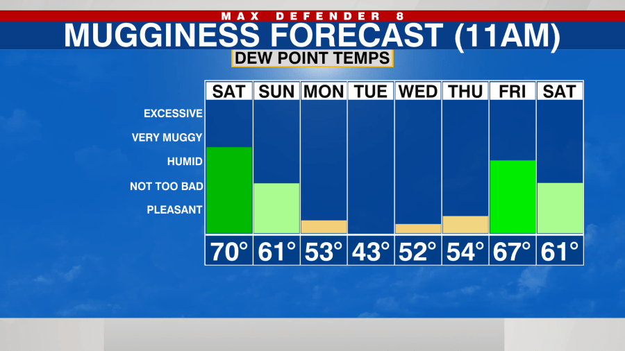
TAMPA, Fla. (WFLA) — The second real cold front of the season will arrive this weekend, bringing in cooler and drier air beginning Sunday and sticking around through the middle of next week.
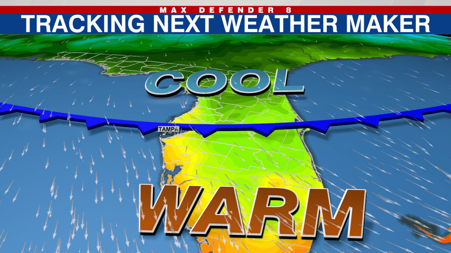
Timeline
Saturday midday
It will still be quite warm and somewhat muggy through the middle of the day Saturday. Temperatures will warm into the mid-80s Saturday afternoon. We’ll see a mixture of sun and clouds and it will be mostly dry.
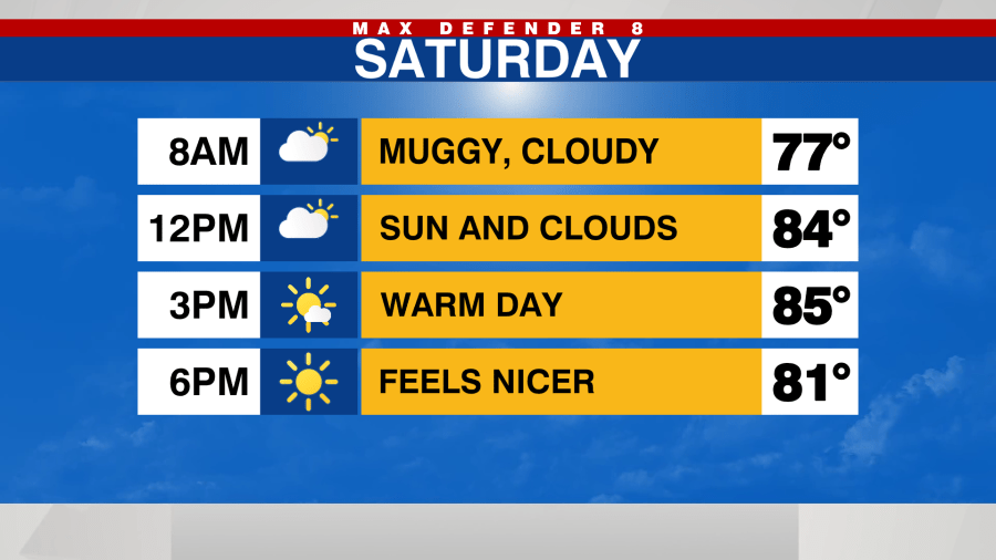
Saturday evening
Although it will still be warm, the mugginess will begin to lower Saturday evening as slightly drier air moves in. Temperatures will drop into the lower 70s Saturday night.
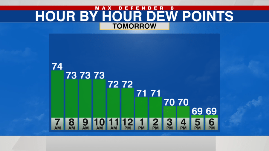
Sunday
The real cold front will pass through the area early Sunday morning. The colder and drier air will filter in throughout the day. The winds will be breezy out of the northwest.
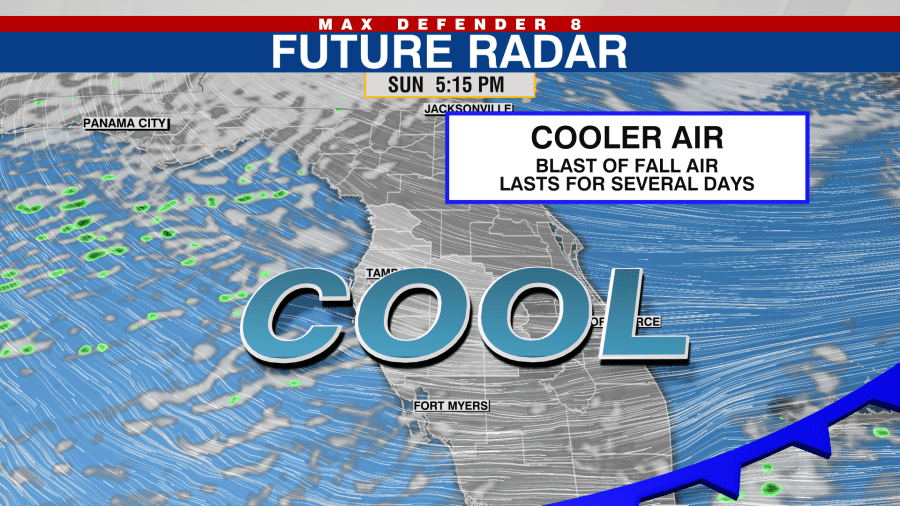
The dew points will drop all day and it continue to get nicer and nicer. Temperatures will warm to near 80 degrees in the middle of the afternoon before dropping quickly Sunday evening.
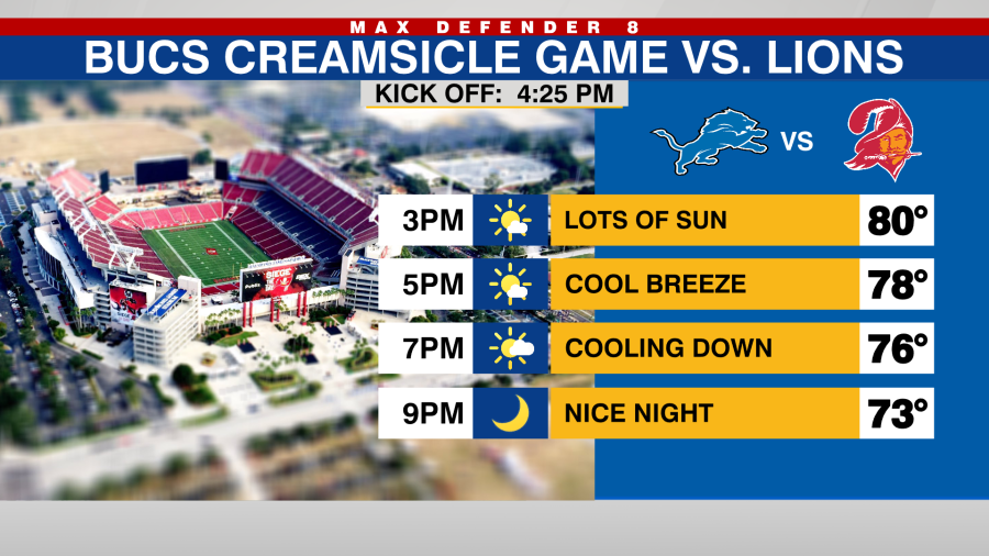
It will be dry and very comfortable for the Bucs game. Temperatures will be dropping into the low 70s for the evening hours.
Monday, Tuesday and Wednesday
The drier and cooler air will be most notable during the first half of the week.
Monday morning will start out in the mid-60s but despite plenty of sunshine, high temperatures will be 10 to 15 below average. Highs in Tampa will only be in the low 70s.

The coolest mornings will be Tuesday and Wednesday morning with temperatures in the mid and upper 50s expected areawide.
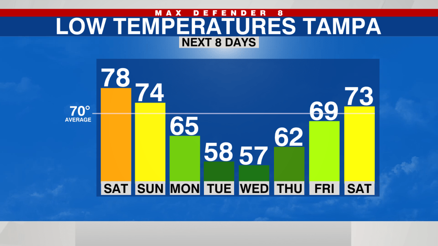
Highs will still be in the low to mid-70s and the dry, comfortable air will still be in place with low humidity. It will truly feel like fall for several days in a row.
Thursday & Friday
A wetter, muggier pattern returns for the end of the week as another frontal system approaches and passes through. It will be warm again with high rain chances to end the week.
