TAMPA, Fla. (WFLA) — The nice weather will continue right into the weekend with warm temperatures and no rain chances. But despite hurricane season ending, tropical development seems likely this week.
Locally high pressure will dominate. That will keep the weather quiet here and help to protect us from any fronts and rainfall. Highs each day will be about 5 degrees above normal – in the low 80s with sun each day.

The next meaningful front will move in early-mid next week with showers Monday/ Tuesday and then colder air on Wednesday. This will mark the beginning of a pattern change to colder by mid-month.

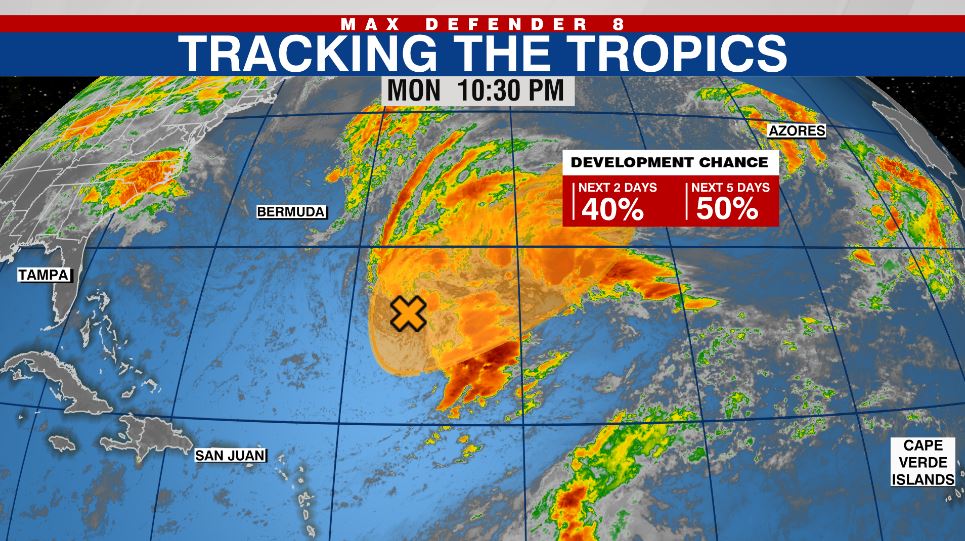
In the Atlantic, a large area of low pressure southeast of Bermuda is in the process of transitioning to a subtropical or tropical entity. The National Hurricane Center gives it a 50% chance of becoming a named system. If it forms the name will be Owen but the storm will move Northeast away from the US.