TAMPA, Fla. (WFLA) – Nicole is weakening and moving quickly out of our area. We will still see on again, off again drizzle overnight into Friday morning as the southernmost outer rain bands make their way through our area.
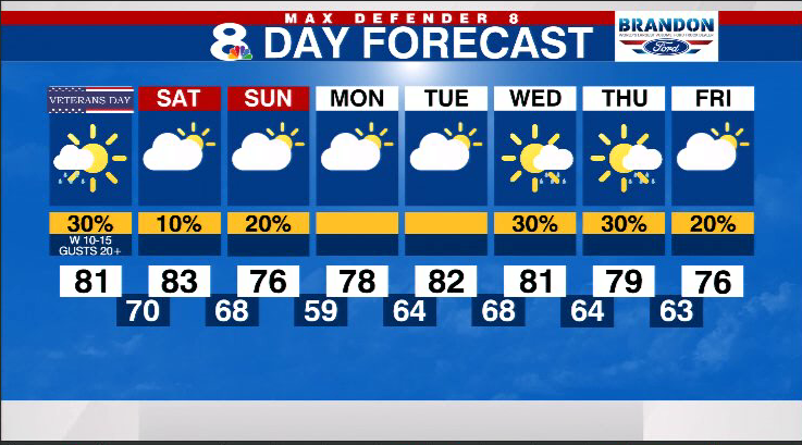
Expect an overcast and breezy day on Friday. The rain bands will continue to cycle around the center, so it stays quite breezy throughout the day. With some breaks in the clouds, highs reach the low 80s.
The strong gusts coming off the Gulf of Mexico tonight and into Friday morning may push Gulf waters farther inland during high tide cycles. Watch for 2-4 feet of surge flooding at those times.
It will be drier for the weekend. We just have a 10% rain chance Saturday as a weak front passes through. Expect slightly cooler air Sunday with highs in the mid 70s.
We remain mostly dry until Wednesday with a 30% chance of a few passing showers.
Stay weather aware on the go with the free Max Defender 8 Weather app. You can also sign up to get daily forecast newsletters and weather alert emails sent to your inbox.


