TAMPA, Fla. (WFLA) — A cold front is forecast to sweep through much of the United States this week, and will usher cooler weather into the Tampa Bay area.
The Tampa Bay area did experience several days of lower temperatures last week in the wake of Hurricane Ian, but returned to regular warmth and humidity this week.
Last week’s cooldown
Max Defender 8 Chief Meteorologist Jeff Berardelli said the lower temperatures Tampa Bay experienced last week can be attributed to Hurricane Ian moving away from Florida.
“After Hurricane Ian passed, the Tampa Bay area had an unusually early shot of comfortable air that was ushered in by the winds around the storm,” Max Defender 8 Chief Meteorologist Jeff Berardelli said. “That can happen after fall hurricanes.”
Return to warmer weather
Warmer weather and higher humidity started settling back into the Tampa Bay area on Sunday.
“This past weekend and the first half of the week, real Florida weather returned with temps near 90 and humid weather,” Berardelli said.
The return to our regular weather pattern is expected to last through Thursday, which is when the cold front is expected to pass through.
Cold front coming
The cold front will bring more rain and cloudy conditions on Thursday. Behind the front, however, Tampa Bay is expected to dry out and will see more comfortable temperatures.
“The cold front will pass through on Thursday – that will be our best chance for rain when this front passes,” Meteorologist Amanda Holly said. “But again, behind it – the cooler, the drier air, it all ushers in pretty quickly.”

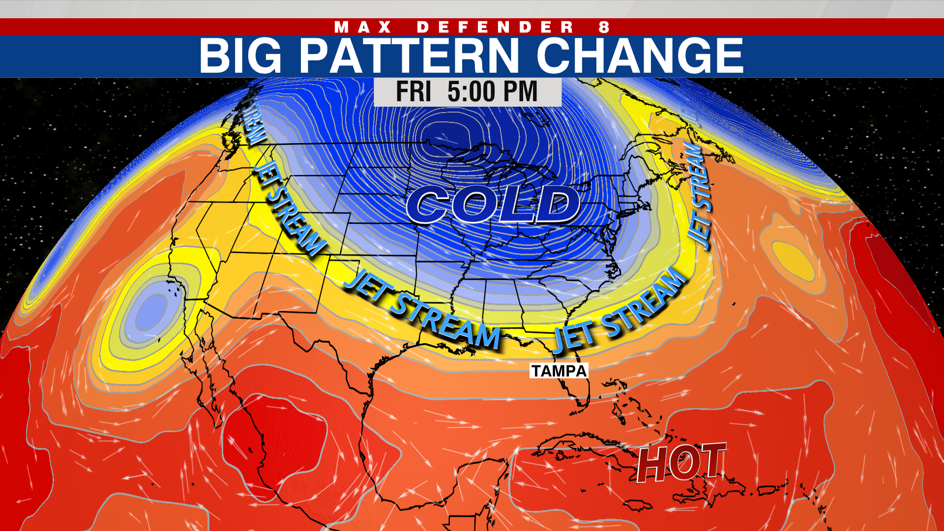
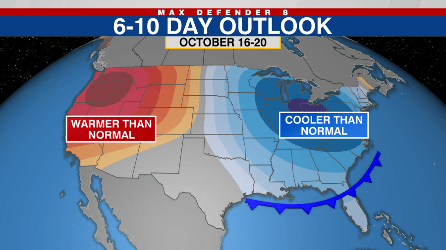
The pattern change coming later this week is thanks to a dip in the jet stream.
“Right now we have a big ridge of high pressure over us. But what we’re seeing happen as we go through the next couple of days is this dip in the jet stream – it’s a big one for this time of year,” Holly said. “So there’s some much colder temperatures for the Midwest, but we are going to get in on the very edge of this front and it will bring us some cooler temperatures.”
The Tampa Bay area will actually see two cold fronts from this changing weather pattern, according to Berardelli.
“The first will arrive Thursday with rain and storms and the cool air will follow that,” he said. “The second will arrive early next week. Both will deliver temperatures that are about 10 degrees below normal for a couple of days and very low humidity. It will be refreshing for this time of year.”


