This story is now archived. For the latest live track for Tropical Storm Ian, click here.
TAMPA, Fla. (WFLA) — Tropical Storm Ian could gain hurricane strength on Sunday, according to predictions by the National Hurricane Center.
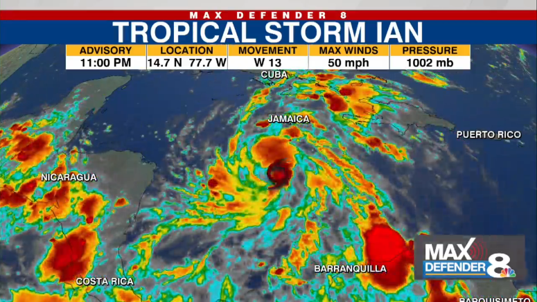
As of the National Hurricane Center’s 11 p.m. update, Ian was about 685 miles southeast of the western tip of Cuba, and about 395 miles southeast of Grand Cayman.

The storm had max sustained winds of 50 mph and was moving west at 13 mph.
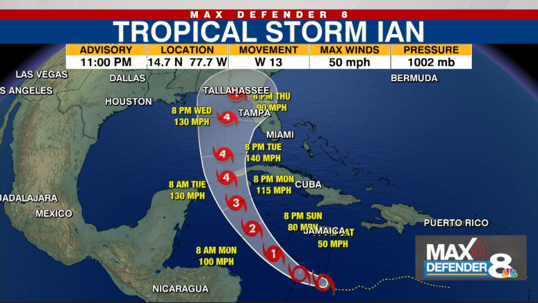
The NHC said the center of Tropical Storm Ian will move over the Caribbean Sea Saturday, gathering strength as it makes its move toward Jamaica and the Cayman Islands Sunday.
“Ian is expected to become a hurricane on Sunday and reach major hurricane strength by late Monday before it reaches western Cuba,” the National Hurricane Center said.
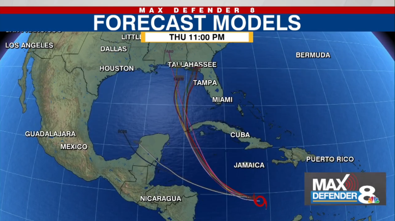
“Ian will likely impact the state of Florida early to mid-week as a strong hurricane,” meteorologist Amanda Holly said. “Our forecast will depend largely on exactly where the center of the storm tracks, and there is still some uncertainty on if it will go a little farther south or even to the north.”

A Hurricane Warning is in effect for:
- Grand Cayman
A Hurricane Watch is in effect for:
- Cuban provinces of Isla de Juventud, Pinar del Rio, and Artemis
A Tropical Storm Watch is in effect for:
- Little Cayman and Cayman Brac
- Cuban provinces of La Habana, Mayabeque, and Matanzas
While Tropical Storm Ian is still a long distance away from Florida, the future hurricane largely is expected to make landfall on the western coast of Florida, with Tampa Bay included in the potential path. However, other paths have it possibly entering the Gulf of Mexico or hitting the Gulf of Mexico.

The NHC said heavy rains could begin for the Florida Keys and the Florida Peninsula through the mid-week, with flash and urban flooding possible. River flooding is also possible, according to the NHC.
“If we see those direct impacts, they could start as early as Tuesday evening with the worst of the weather on Wednesday night and into Thursday,” Holly said.
As of the latest update, the Florida Keys and South Florida could see two to four inches of rain through Tuesday evening, with a local maximum of six inches.
However, the more immediate threat is to the islands in the Caribbean — such as Cuba, Jamaica, and the Cayman Islands — which could see heavy rainfall, flooding, and mudslides.


