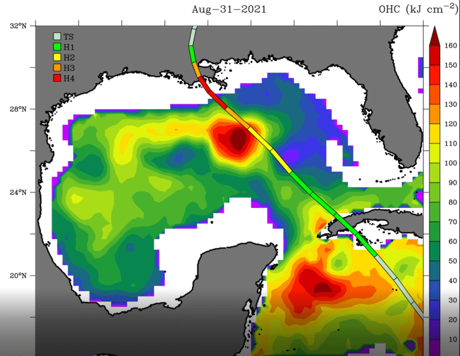
TAMPA, Fla. (WFLA) — The Gulf Loop Current is a large pool of hot water a couple hundred miles west of Tampa Bay. This hurricane season, it’s looking even more imposing than normal.
The loop current originates as deep tropical water that comes out of the Caribbean, through the Yucatan Straits, and intrudes into the Gulf of Mexico. The loop often breaks off into what we call warm core eddies.

When hurricanes meet up with these warm cores, explosive development usually follows.
“One of the big problems in current forecasting is what happens during rapid intensity change, and that affects everyone in the Gulf, particularly on the West Florida shelf,” explained Nick Shay, a professor of oceanography in the Ocean Sciences Department at the University of Miami’s Rosenstiel School of Marine and Atmospheric Science.
Max Defender 8 Chief Meteorologist and Climate Specialist Jeff Berardelli went to visit Shay in Miami before hurricane season began to discuss his research.
In a recent article, Shay warned that this year’s loop current looks more ominous than has in recent years. “You can think of the loop current water as higher octane fuel at your fuel pump,” Shay said.
That can power stronger hurricanes. “In 2005 hurricane Katrina and Rita both explosively deepened over the loop current warm core,” explains Shay.
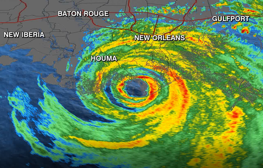
Last year, Hurricane Ida passed through the loop current, spiking 65 mph in just 24 hours, right before landfall. Shay says lately the loop current is getting even warmer and it may be due to human-caused climate change.

“In that big warm core eddy than energized Ida the heat content units were roughly 15 to 20 percent higher than they have been over the past decade or so which leads me to believe that some of this has to be linked to a warming climate,” said Shay.
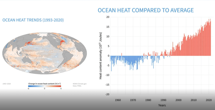
Each year, ocean heat content sets new records because 90% of the excess heat humans are producing is stored in the ocean. And that comes back to haunt us.

That helps shed light on another mystery of storm behavior called eye wall replacement cycles.
“Where the successful eyewall replacement cycles occur is over the deep warm water. The reason is, the ocean has to feed two eye walls and not just one,” Shay explained.

Shay’s latest work is on the leading edge of hurricane science, trying to better understand the interface between ocean and atmosphere by deploying high tech floats, drifters and gliders. This, he says, will help scientists analyze attributes of the loop current. This is a key to better forecasting the evolution of Gulf of Mexico monsters.
Stay weather aware on the go with the free Max Defender 8 Weather app. You can also sign up to get daily forecast newsletters and weather alert emails sent to your inbox.


